How Fit Do I Need To Be To Walk The Tongariro Crossing?
A plain answer to how fit you need to be for the Tongariro Alpine Crossing, with DOC's grading, the terrain section by section, a training plan, and a shorter guided walk option.
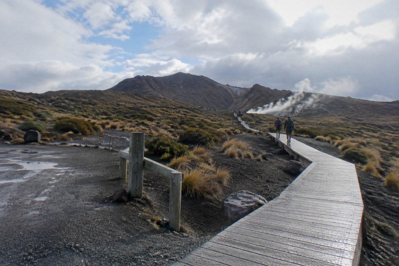
The Department of Conservation grades the Tongariro Alpine Crossing as requiring High fitness. DOC allows 7 to 8 hours of walking from November to April, and 9 hours from May to October.
Plenty of ordinary, non-athlete walkers finish it every summer. But they finish it because they treated the grading seriously, trained for it, packed for alpine conditions, and gave themselves the option of turning back. This page breaks down what High fitness actually demands on this track, which sections decide your day, how to prepare, and what the fallback options are if a 20.2 km alpine day is beyond your current condition.
You need to be comfortable walking for 7 to 8 hours over steep, undulating alpine terrain at altitude, covering 20.2 km with 1196 m of climb and the same again of descent. DOC grades the fitness requirement High, calls the gradient steep and undulating, and classifies the track as Intermediate in summer. If you can manage a full-day mountain hike with sustained climbs on rough ground, you are in the right zone.
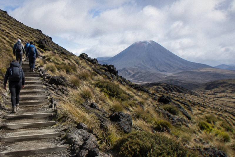
That is the honest baseline, and it deserves unpacking, because "fit" means different things to different people. The Crossing is not a scramble and it is not a climb. There is no roped section and no technical ground in summer. What there is, is relentless up and down: a long valley walk, a steep staircase of roughly 350 m of climbing to the South Crater plateau, a further ascent to Red Crater at 1886 m, a steep scree descent on loose rock to the Emerald Lakes, then a long zig-zag descent with views over Lake Rotoaira and Lake Taupo before forest and the finish at Ketetahi Road. If you're wondering which of those sections will demand the most of your legs, the ranked guide to the Crossing's toughest sections explains exactly where the real effort sits.
The combination is what catches people out. The descent, with many steps on the northern slopes, is the part that can trouble weaker knees. DOC itself flags the loose rock on Red Crater as a major slip hazard and the stepped descent as trouble for weaker knees. Fitness for this track means legs that can go down as well as up, late in the day, when tired.
“Ideal transfer for the Tongariro Crossing. The driver was punctual and cheerful. The time for the hike is definitely enough.”
Altitude matters too, in a modest way. The highest point, Red Crater at 1886 m, is not high enough to cause altitude sickness for most people, but the air is thinner than at the 1120 m start, and the temperature is much colder. On a calm day DOC says Red Crater is at least 10 °C colder than Taupo and 5 °C colder than the track start, and you subtract another 2 °C for every 10 km/h of wind. Cold, tired legs are slower and clumsier legs, which is how slips happen: DOC notes that 38 percent of tramping injuries come from slipping.
So the practical answer: if you regularly walk 15 km or more on hilly terrain, and you have done at least a few full-day hikes, you are likely fit enough with the right pacing and gear. If a 10 km flat walk leaves you sore the next day, the full Crossing will be a long, potentially unsafe day, and a shorter guided walk is a better use of your time in the park.
For walkers who want the security of a guide on that full terrain, the premium guided Tongariro Crossing hike from Adrift Tongariro runs 8 to 9 hours door to door, from $253 per person, rated 4.6 across 241 reviews, with return transport from the base at 53 Carroll Street, National Park Village included.
What Does DOC's High Fitness Grading Actually Mean?
On the Crossing specifically, DOC pairs the grading with a 20.2 km one-way distance, an Intermediate track category in summer, and an Expert route classification from May to October. It is a genuine alpine day walk, not a stroll.
The grading is worth believing because DOC maintains this track and watches who gets into trouble on it. The page for the Crossing lists the hazards plainly: steep and undulating gradient, loose scree on Red Crater, ice possible from April to October, and toilets spaced only every 1 to 2 hours of walking. There is no water you can drink along the track, so you carry your own, 2 to 3 litres per person by DOC's recommendation, which adds meaningful weight to your pack for the whole 20.2 km.
The summer and winter classifications differ sharply, and that difference feeds straight back into the fitness question. From November to April the track is an Intermediate tramping track and Manaaki Rangers greet visitors daily. From May to late October DOC calls it an Expert route: snow and ice in sections, avalanche risk, sub-zero temperatures, and 9 hours of walking against only 9 to 11 hours of daylight. DOC's winter essentials list includes crampons, ice axe and helmet, plus avalanche rescue gear for independent trips, and the winter advice is blunt: go with a guide. Winter fitness is not just cardio fitness, it is alpine skill, and the two are not the same thing.
It also helps to know what the grading is protecting you from. The hazard zone around the track's three volcanic vents, Te Maari, Red Crater and Ngauruhoe, carries a 3 km radius, and the most recent eruption from Te Maari was in 2012. The terrain is active, exposed and unforgiving of a twisted ankle two hours from the road end.
The official track page with the full grading, hazards and seasonal detail is on the DOC Tongariro Alpine Crossing page, and it is the right final check before any walk.
Which Parts Of The Tongariro Crossing Are Hardest?
The three decisive sections are the Devils Staircase climb of about 350 m to South Crater, the ascent to Red Crater at 1886 m on loose ground, and the long stepped descent from the Emerald Lakes toward Ketetahi Road. The first 5.4 km, shared with the easy Soda Springs Walk, is the gentlest part. Most walkers who struggle do so on the staircase going up or on the steps coming down, not in the valley.
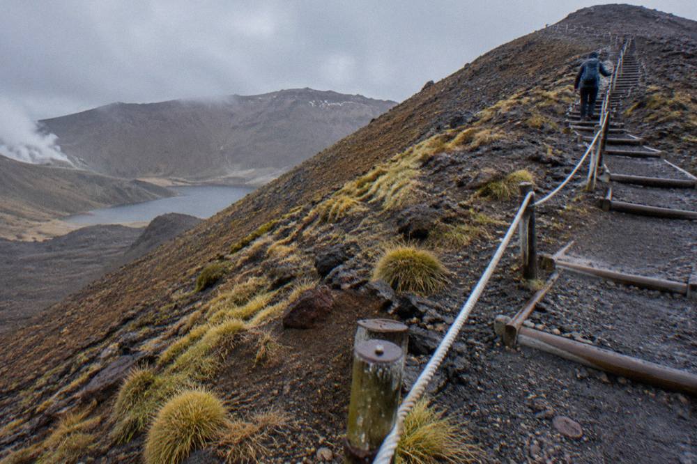
The shape of the day explains why. The walk begins on boardwalk through Mangatepopo Valley, flat and scenic, following the same line as the 2-hour return Soda Springs Walk that DOC marks as an easy option. Then the climbing starts in earnest. The staircase to the South Crater plateau is a relentless grind on constructed steps, roughly 350 m of ascent, and it is where the day's first honest reckoning happens. South Crater itself is a false flat, a brief reprieve, before the track climbs again to Red Crater, the 1886 m high point, on steep, loose ground.
From Red Crater the character flips. The descent to the Emerald Lakes is steep scree, and DOC singles out the loose rock here as a major slip hazard. It demands attention with every step, and tired legs pay less attention. After the lakes and Blue Lake, the track zig-zags down the northern slopes on a long descent with many steps, the section DOC flags for weaker knees, before easing through forest to the road end at Ketetahi.
The following table puts the day in order, with what each part asks of your body:
| Track section | What it asks of you | Where people struggle |
|---|---|---|
| Mangatepopo Valley boardwalk, first 5.4 km | Gentle walking, warming up | Rarely |
| Devils Staircase to South Crater | About 350 m of steady climbing on steps | Breathing, pace, heat |
| South Crater to Red Crater, 1886 m | Steep ascent, loose ground, exposure | Legs, cold, wind |
| Red Crater to Emerald Lakes | Steep scree descent, slip hazard | Concentration, tired legs |
| Emerald Lakes to Ketetahi Road | Long stepped descent, then forest | Knees, endurance late in the day |
There is also a cumulative effect that the table cannot show. The hardest individual section may be the staircase, but the walk that breaks people is the last third, when 6 or 7 hours of effort have already been spent and the descent keeps going. This is why training should build time on your feet, not just hill strength.
How Should I Train For The Tongariro Crossing?
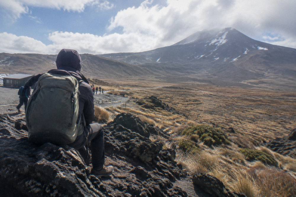
Start training six to eight weeks out, with one long walk each week building from 10 km toward 20.2 km on hilly terrain, plus weekly hill or stair repeats for climbing strength and step-downs for the descent. Wear the boots you will wear on the day. By the final fortnight you should have completed at least one full-day walk of 15 km or more with your packed load, without needing two days to recover.
A simple weekly pattern works for most people planning a summer Crossing:
| Weeks out | Weekly long walk | Weekly strength focus | Notes |
|---|---|---|---|
| 8 | 10 km, gentle hills | Stair climbs, 2 sessions | Break in the boots now |
| 6 | 13 km, hills | Stairs plus step-downs | Add pack weight, 3 to 5 kg |
| 4 | 16 km, steep sections | Step-downs, balance work | Practice poles if using them |
| 2 | 20.2 km, full day | Maintain | Full pack, full lunch, full pace |
| 1 | 8 km easy | Rest | Taper, sleep, pack properly |
Three training details matter more than people expect. First, downhill loading: step-downs, slow stair descents and long descents in training protect your knees on the northern slopes, where many steps can trouble weaker knees. Second, time on feet: the Crossing is a 7 to 8 hour day in summer, and a body that has only ever walked for three hours does not know how to ration effort, eat on the move and keep warm late in the day. Third, your actual boots: sturdy boots are on DOC's gear list, and a blister at kilometre 8 can end a walk that your fitness could have carried.
Weather preparation belongs in the training block too, because fitness and conditions interact. The summer Not Recommended Today advisory triggers on thresholds like average winds of 55 kph or more, gusts of 70 kph or more, or 2.5 mm per hour of rain at Red Crater, assessed each morning against the NIWA Red Crater forecast. Training in some wind and drizzle, rather than only perfect days, builds the resilience the track occasionally asks for. Check the avalanche forecast for the region if you are walking outside the summer months.
Is There A Shorter Option If I Am Not Fit Enough?
Yes. DOC marks the first 5.4 km, shared with the Soda Springs Walk, as an easy 2-hour return option for people without the fitness for the harder parts. Beyond that, Adrift Tongariro runs a guided half-day walk, 4 hours total, from $197 per person, rated 4.7 across 27 reviews, which is a shorter guided walk and not the full Crossing. Both give you the landscape without committing you to 1196 m of climbing.
The Soda Springs fallback is free, self-guided and genuinely pleasant: it follows the same boardwalked valley, gives views up the valley toward the volcanic ridges, and returns on the same line. DOC explicitly designed it as the option for walkers who arrive, assess the staircase ahead, and make the sensible call. Turning back at the Soda Springs is not failure, it is the decision the route exists to enable. The rest of the planning pages sit on Tongariro Alpine Crossing Tours.
The guided half-day option suits walkers who want the security and interpretation of a guide on a shorter day. Adrift Tongariro's half-day guided walk runs from its base at 53 Carroll Street, National Park Village, includes return transport as a round trip, and supplies crampons and ice axes for winter conditions if required, plus a clothing and footwear allowance. It is rated 4.7 across 27 reviews and costs from $197 per person. Bring your own lunch, since food is not included. It is a guided walk in the same landscape, but it is not the full Crossing, and it should not be booked by anyone set on Red Crater and the Emerald Lakes.
For context on the two guided intensities side by side: the full premium guided Crossing hike covers the whole 20.2 km with a guide, from $253 per person, minimum age 12, group size up to 60, and free cancellation up to 14 days in advance. For the half-day walk, check the booking page for the age rule; it has the same 14-day cancellation window. Choosing between them is honestly a fitness decision, and there is no shame in the shorter day. A fuller comparison of the guided formats is in the full Tongariro Crossing walkthrough.
Can Children Do The Tongariro Crossing?
DOC advises that the track is not recommended for children under 10, and the operator age rules on top of that are stricter: the Adrift premium guided hike and private guided Crossing both set a minimum age of 12, and the ExperienceKart three-day tour is not suitable under 12. For the Adrift half-day walk, check the booking page for the age rule. For independent family walks, the Soda Springs option and the Taranaki Falls or Tama Lakes tracks are the family-friendly alternatives.
The under-10 advice is DOC's, and it reflects the same arithmetic as the adult fitness question, compressed: a child who cannot reliably walk for 7 to 8 hours, manage loose scree, and stay warm and fed through an alpine day is not safe on the full track, and a parent carrying a tired child down the northern steps is at risk too. The 20.2 km distance and the exposed sections above South Crater leave no shortcuts and no early exits once you are past the Soda Springs turn.
The operator rules layer on top. Adrift Tongariro's premium guided hike sets a minimum age of 12, and so does its private guided Crossing. Dempsey Buses excludes children under 6 on its shuttles, and National Park Shuttles' one-way park-and-ride sets a minimum age of 8. These are per-operator rules, not park rules, so check the specific tour's terms before booking for a family.
The practical family route into this landscape is the shorter ground. The Soda Springs Walk gives the valley and the volcanic skyline in an easy 2 hours return, and DOC itself names the Taranaki Falls Walking Track and Tama Lakes Track as alternatives in poor weather or for shorter days. Children who love the mountain scenery lose nothing by starting there.
Does A Shuttle Or A Guide Change The Fitness You Need?
No. A shuttle changes only the logistics of getting to Mangatepopo and home from Ketetahi Road, and a guide adds safety, gear and local knowledge, but the 20.2 km, the 1196 m of climbing and the steep terrain are identical either way. Shuttles are not guided: only the three Adrift Tongariro tours are guided. What a shuttle or guide does change is the shape of your day, with an early start and a set pickup at the far end.
That day shape has a real fitness consequence: a booked return fixes your finish. Walking with a shuttle pickup waiting at Ketetahi Road, or with a guided group on the move, removes the luxury of a very slow day. Most walkers find this motivating, but it is worth knowing before you book that a set afternoon collection compresses your margin for rest stops, and that rushing the scree or the steps is exactly how slips happen.
The shuttle options from National Park Village illustrate the range. The Tongariro Crossing Shuttles round trip runs from $42 per person, rated 4.7 across 886 reviews, with free cancellation up to 24 hours in advance, making it the most reviewed tour here. It departs from the Park n Ride at 59 Findlay Street, National Park Village, in the morning and collects from Ketetahi in the afternoon. Dempsey Buses runs a comparable round trip from National Park Village, from $51 per person, rated 4.8 across 72 reviews. A wider comparison of Tongariro Crossing shuttle options covers the differences.
A guided day adds more than transport. On the Adrift premium guided hike the guide, return transport, and winter gear including crampons and ice axes if conditions require them are all part of the booking, along with a clothing and footwear allowance, and the group runs at up to 60 people with a guide making the day's go or no-go call within DOC's advisory system. Operators have agreed, as part of their concessions, not to operate when a Hazardous Weather Warning has been issued, which is a safety net an independent walker has to build for themselves by reading the forecasts.
What Should Less Confident Walkers Do Differently On The Day?
Walk the track early in the day, pace the valley conservatively so you reach the staircase fresh, use poles for the descents, eat and drink on a schedule rather than when exhausted, and set a turnaround rule before you start. Book a shuttle so the logistics are fixed, consider a guide, and treat DOC's not-recommended advisories as absolute.
The first 5.4 km feels easy and invites speed, which spends energy the staircase will demand with interest. A steady valley pace, a short break at the Soda Springs, and small, frequent snacks beat a fast start and a stall every time. Hydrate on schedule too, because there is no drinkable water on the track and dehydration quietly degrades balance, which matters most on the scree below Red Crater.
Poles earn their place specifically on the descents. Poles are also weight you train with, so add them to your long training walks rather than introducing them on the day.
The turnaround rule deserves to be decided at the trailhead, not at Red Crater. Once past the Soda Springs junction there is no short way out, and DOC's advice for poor conditions includes the Taranaki Falls and Tama Lakes tracks as alternatives. The sacred mountains carry their own request, which DOC conveys from Ngati Hikairo ki Tongariro: respect the maunga by not touching or entering any of the waterways, including the alpine lakes. Staying on the track, and being willing to turn back on it, is both a safety practice and the respectful one.
Finally, book the walk itself. The DOC track booking system, free since October 2023, is recommended for everyone and required if you use a shuttle or guided service, and your guide or shuttle operator may make the booking for you. The mechanics are covered in detail in booking the Tongariro Crossing.
Common Questions About Tongariro Crossing Fitness
How Fit Do I Need To Be To Walk The Tongariro Crossing?
You need High fitness by DOC's grading: the ability to walk 7 to 8 hours in summer over 20.2 km of steep, undulating alpine terrain with 1196 m of climb and descent. Regular walkers who can manage a 15 km plus hill day with a pack are in range. If that is beyond you, DOC's Soda Springs Walk or a guided half-day walk are the right alternatives.
Can An Unfit Person Do The Tongariro Crossing?
An unfit walker should not attempt the full track. The day combines a 350 m staircase, a climb to 1886 m at Red Crater, a steep scree descent and a long stepped finish, with no early exits past the Soda Springs junction. The Soda Springs Walk, an easy 2-hour return over the first 5.4 km, exists exactly for walkers who make that call.
How Long Does The Tongariro Crossing Take An Average Walker?
DOC allows 7 to 8 hours from November to April and 9 hours from May to October. Those are walking times, not tour durations: booked tours and shuttles run longer door to door, such as the Adrift premium guided hike at 8 to 9 hours including transport. Average walkers should plan for the upper end of the range and an early start.
Is The Tongariro Crossing Harder Going Up Or Coming Down?
Both, in different ways. The Devils Staircase and the climb to Red Crater are the hardest cardiovascular effort, but the steep scree below Red Crater and the many steps of the northern descent are where tired legs, weak knees and slips do the damage. Train step-downs as seriously as stair climbs.
Do I Need A Guide If I Am Only Moderately Fit?
A guide does not reduce the physical demand, but it adds pacing experience, gear for winter conditions, transport and a professional go or no-go call on the weather. Adrift Tongariro runs the three guided tours shown here, from the $197 per person half-day walk to the $253 per person premium guided Crossing hike, both with free cancellation up to 14 days in advance.