How Safe Is The Tongariro Crossing?
An honest safety briefing for the Tongariro Alpine Crossing: volcanic hazards, weather advisories, winter conditions, gear, and when a guided hike or shuttle makes sense.
The Tongariro Alpine Crossing is safe for well-prepared, highly fit walkers in good summer conditions and genuinely hazardous without that preparation. DOC grades it an intermediate tramping track from November to April and an expert alpine route from May to late October, so your real safety depends on the season, the weather on the day, and the gear you carry.
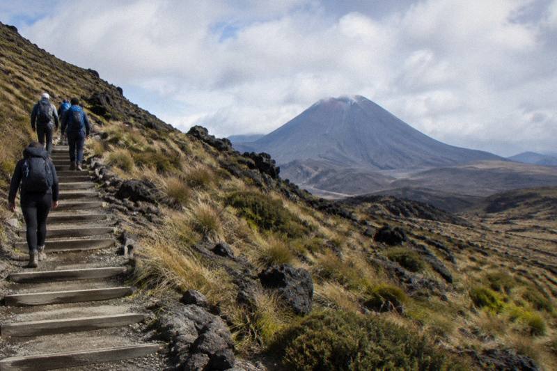
The Department of Conservation, which manages the track, does not mince words about what it is. Fitness required: high. Gradient: steep and undulating. Walking time 7 to 8 hours from November to April, and 9 hours across winter. The start sits at 1120 m at Mangatepopo, the high point is Red Crater at 1886 m, and the finish drops to about 760 m at Ketetahi Road, an elevation change of plus and minus 1196 m. That profile alone rules out the casual stroll framing that some travel content leans on.
None of this means the Crossing is dangerous in the way a rope bridge or a via ferrata is dangerous. The risks that do exist are specific and, for the most part, predictable: weather that turns, ice underfoot, loose rock on the crater slopes, and volcanic ground that behaves like volcanic ground.
The purpose of this page is to lay those risks out plainly, using DOC's own published guidance, so you can judge for yourself whether to walk independently, take a shuttle, or book a guided hike.
What Are The Main Dangers On The Tongariro Alpine Crossing?
The Department of Conservation identifies four main hazards on the Tongariro Alpine Crossing: an active volcanic environment, fast-changing alpine weather, ice and snow on the track, and loose rock such as the scree on Red Crater. In practice, weather and underfoot conditions cause most injuries, with DOC attributing 38 percent of tramping injuries to slipping, while volcanic eruptions remain unlikely though possible at any time.
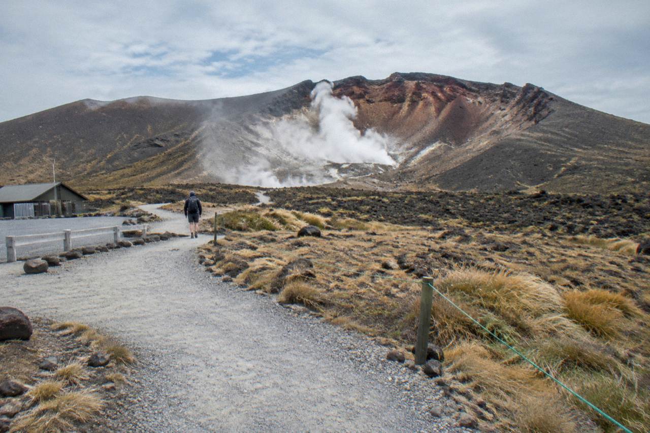
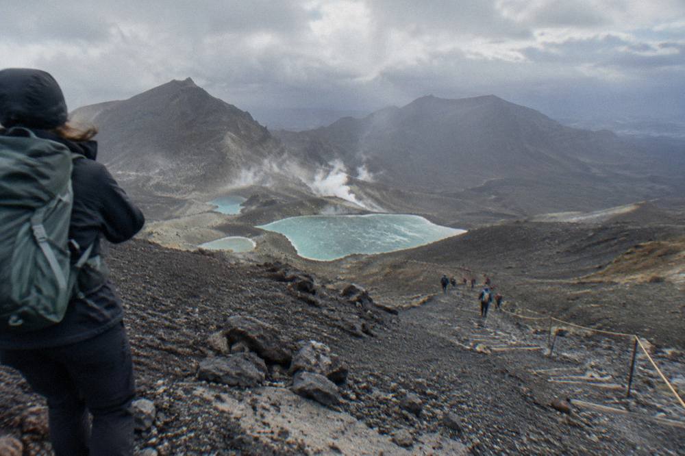
Start with the ground itself. The Crossing traverses an active volcanic area with a hazard zone drawn as a 3 km radius around each of the three Tongariro vents: Te Maari, Red Crater and Ngauruhoe. Steam rises from fumaroles near the Emerald Lakes, and DOC asks walkers not to approach the vents. The most recent eruption was from Te Maari in 2012, and the monitoring network run by GeoNet watches the volcano continuously. If volcanic activity rises at Tongariro or Ngauruhoe, DOC will close sections or the whole track; if unrest centres on Red Crater or is uncertain, the whole Crossing closes. In ordinary times the volcanic risk sits quietly in the background, but it is why the track exists in this shape at all, and why it will never be flattened into a theme-park boardwalk.
The everyday dangers are more mundane and more likely to affect your day. Loose rock on Red Crater is flagged by DOC as a major slip hazard, and the long stepped descent toward Ketetahi punishes weaker knees. Weather at 1886 m bears no relation to weather in Taupo: on a calm day DOC says Red Crater is at least 10 °C colder than Taupo and 5 °C colder than the track start, and you subtract another 2 °C for every 10 km/h of wind. A pleasant autumn morning in town can be a sub-zero, gusting afternoon on the crater rim.
| Hazard | Where it applies | What DOC advises |
|---|---|---|
| Loose scree and rockfall | Red Crater ascent and descent | Take care on the scree, it is a major slip hazard |
| Ice and snow | April to October, anywhere on the track | Crampons, ice axe and helmet essential, with competency using them |
| Wind and wind chill | Red Crater and exposed ridges | Check the NIWA Red Crater forecast before setting out |
| Geothermal vents | Near the Emerald Lakes | Do not approach fumaroles or steam vents |
| Volcanic activity | The whole hazard zone | Eruptions unlikely but possible; follow any DOC closure |
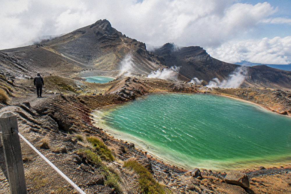
Alongside the physical hazards, DOC asks visitors to respect cultural rules that also protect the place: Ngati Hikairo ki Tongariro ask walkers not to touch or enter any of the waterways, including the alpine lakes, and the park's standing as New Zealand's oldest national park (1894) and a dual World Heritage area reflects how seriously the mountains are held. Drones are not permitted without a permit, and dogs are not allowed at all.
If reading that table makes you reconsider walking it alone, a guided day costs more but removes the gear and navigation questions. The box below shows one of the bookable options for the Tongariro Alpine Crossing.
Does The Weather Actually Stop The Tongariro Crossing?
Yes, the weather genuinely stops the Tongariro Crossing. Each morning in summer, DOC checks the NIWA Red Crater forecast, and when wind, wind chill, rain or snow cross defined thresholds, it issues a Not Recommended Today advisory. Signs appear at the Mangatepopo road end, the NIWA page shows the alert, and operators and isites get emailed. Operators have agreed, as part of their concessions, not to operate when a Hazardous Weather Warning is issued.
The thresholds are precise, which is worth knowing, because they tell you what kind of day counts as a bad day. An advisory is triggered when any two-hour window across the middle of the day shows average wind of 55 kph or more, gusts of 70 kph or more, a wind chill of -10 °C or colder, a wind chill of 0 °C or colder combined with 1 mm of precipitation or more, a rain rate of 2.5 mm per hour or more, or snow falling at 0.1 cm per hour or more, and when 10 mm of precipitation falls over six hours. None of those describes a day you would choose for a ridge walk at nearly 1900 m.
In winter the picture changes shape. All operators have agreed, as part of their concessions with DOC, not to operate when a Hazardous Weather Warning has been issued, so a booked guided hike or shuttle will not depart in those conditions rather than push through.
The practical safety habit is simple. Check the DOC Tongariro Alpine Crossing page for alerts, the NIWA Red Crater forecast for conditions at the top, and the MetService mountain forecast as a cross-check. Build a plan B: DOC names the Taranaki Falls Walking Track and the Tama Lakes Track as alternatives in poor weather, and the first 5.4 km of the Crossing shares its line with the easy two-hour Soda Springs walk, which is DOC's own suggested fallback for people without the fitness for the harder parts.
Is Winter On The Tongariro Crossing More Dangerous Than Summer?
Yes, materially: from May to late October DOC reclassifies the Crossing from an intermediate tramping track to an expert alpine route, where snow, ice, avalanche risk and sub-zero temperatures come into play. With winter daylight lasting only 9 to 11 hours and DOC advising 9 hours for the walk, a head torch is mandatory, crampons, an ice axe and a helmet are essential, and independent walkers need avalanche equipment plus the skills to use it.
Winter conditions compress every summer hazard into a harder package. Ice can coat the track from April onward, hiding the loose rock and the steps. Marker poles disappear under cloud or snow, and DOC expects winter walkers to be able to navigate without them. The temperature rule from the previous section still applies, only more so, and the 38 percent slipping statistic is the failure mode DOC most wants to prevent.
For independent winter trips DOC lists avalanche gear, a transceiver, probe and shovel, alongside a PLB, a head torch with spare batteries, and map, compass or GPS. The avalanche forecast for the region is published at avalanche.net.nz and should be read the way you would read a marine forecast before a boat trip. DOC's summary of who winter suits is blunt: people with alpine skills, equipment and experience who can navigate hidden ground, rescue a companion in avalanche terrain, prevent a slide on ice, and survive worsening weather. For anyone short of that list, DOC's advice is short: go with a guide.
There is a logistics consequence too. Shuttle buses generally do not operate in winter, while guided trips include transport. The Adrift Tongariro guided tours run in both summer and winter seasons, supply crampons and ice axes for winter conditions if required, and include a clothing and footwear allowance, which is exactly the gear gap that catches out visitors who arrive expecting a summer walk in June.
How Does A Guided Tour Change Safety On The Tongariro Crossing?
A guided tour does not remove the hazards on the Tongariro Crossing, but it shifts preparation, gear and weather judgement onto an operator that DOC rules keep off the track on hazardous-weather-warning days.
Honesty matters here, so it is worth being precise about what a guide is not. A guide cannot calm the wind, warm the crater or make the scree less loose. What the guided product changes is that the alpine-skills checklist DOC publishes for winter, navigation, avalanche awareness, slide prevention, is carried by a professional rather than asked of you, and the group walks with the correct equipment rather than whatever was in a suitcase. The premium guided hike runs 8 to 9 hours as a booked day, is rated 4.6 across 241 reviews, and costs from $253 per person, with free cancellation up to 14 days in advance for a full refund and a minimum age of 12. The full index of guides sits on Tongariro Alpine Crossing Tours.
Two details from the operator's own terms are worth flagging before you book. Hotel pickup is not included, so you make your own way to the National Park Village base, and lunch is an optional extra, so bring your own. The group maximum is 60. The private guided version covers the same ground with only your group, from $774.01, minimum age 12, and it is non-refundable, which is a genuine consideration when mountain weather can move a booking.
For walkers who want the transport and logistics handled but not a guide, the shuttle side of the market is separate and cheaper. Shuttles are transport, not guided walks, and only the Adrift tours carry a guide.
Is It Safe To Do The Tongariro Crossing Without A Guide?
Yes, in summer it is safe to cross unguided if you have high fitness, proper boots and layers, food, 2 to 3 litres of water, and the discipline to check the Red Crater forecast and turn back if conditions deteriorate. Outside the summer season, DOC's advice is unambiguous: supply your own winter equipment or go with a guide.
The self-guided summer day is the normal shape of a Crossing visit. The free booking takes minutes, shuttles handle the road ends so you never leave a car in a 4-hour summer parking zone, and the track is busy enough in peak season that route-finding is rarely an issue. Toilets sit every 1 to 2 hours along the route, and if there is a queue at Mangatepopo the next toilets are 1 km, about 20 minutes, up the valley.
The failure mode for independent walkers is almost never getting lost. It is starting in weather that was forecast to turn, wearing shoes that were never going to survive volcanic rock, or pressing on for the lakes when the group is already tired. DOC's gear list, base layer, insulation and shell, sturdy boots, hat, gloves and sunscreen, exists because the mountain serves all four seasons in a single day. The site's guide to what to bring on the hike works through that list item by item, and the question of whether you can hike Tongariro without a guide is covered in full elsewhere.
One cultural note belongs in any safety conversation, because safety here includes not causing harm. The mountains are sacred to Ngati Hikairo ki Tongariro of Ngati Tuwharetoa, guardians of the maunga, and the request that accompanies every safety briefing is to respect the sanctity of the sacred mountains by not touching or entering any of the waterways, including the alpine lakes. The emerald and blue lakes that photograph so well are not swimming holes.
Is The Tongariro Crossing Safe For Children And Older Walkers?
Broadly yes, with conditions: DOC does not recommend the track for children under 10, and the staircase climb and Red Crater scree demand honest assessment for anyone with knee, heart or breathing trouble, so fit older walkers should weigh those sections carefully, while operator age rules vary: Dempsey Buses excludes under 6, National Park Shuttles sets a minimum of 8, and Adrift and the ExperienceKart three-day tour set 12.
The 20.2 km distance is only part of the story. The climb from the Mangatepopo Valley includes a steady rise of around 350 m up a staircase to the South Crater plateau, then the push to Red Crater, then a steep scree descent to the Emerald Lakes and a long zig-zag drop on northern slopes. DOC warns that many steps on the descent can trouble weaker knees. DOC grades the fitness required as High: continuous walking over steep, undulating ground for the full duration of the walk.
Families with younger children or mixed-fitness groups have a sanctioned fallback: the Soda Springs walk, the first 5.4 km shared with the Crossing, an easy two-hour return option DOC describes for people without the fitness for the harder parts. It reaches the valley's springs and turns back without touching the crater. Older walkers often split the day the same way, or choose the Adrift half-day guided walk, a four-hour guided option from $197 rated 4.7 across 27 reviews, which is a shorter walk and not the full Crossing.
What Should You Do If Something Goes Wrong On The Crossing?
Carry a way to call or signal for help, accept that rescue on an alpine track takes time, and decide to turn back early rather than late.
Prevention does most of the work. That means the booking receipt shown to rangers at the carpark, water, layers and food carried rather than assumed, and the discipline of the turnaround point chosen before you start. DOC's post-fire guidance adds two small acts of care: clean your shoes and gear before and after, to avoid moving pests and seeds between areas, and carry out all rubbish.
When the day goes wrong in small ways, blisters, fatigue, cold hands, the answer is to stop and fix it rather than rush. When it goes wrong in big ways, the summer season is the one with a daily ranger presence, the Manaaki Rangers greeting visitors from November to April. Outside those months the responsibility for the call sits squarely with the party. Nobody should plan on being rescued: DOC's whole safety architecture, the advisory system, the gear lists, the grades, exists so that the rescue is the exception rather than the itinerary.
For most readers the decision comes down to format: guided and fully equipped, private with your own group, or shuttle-assisted and independent. The three below are the ones this site compares most often.
Common Questions About Tongariro Crossing Safety
How Safe Is The Tongariro Crossing?
Safe for high-fitness, well-equipped walkers in good summer conditions, and an expert-only alpine route from May to late October. DOC grades the track intermediate in summer and expert in winter, names loose scree, ice, weather and the active volcanic environment as the hazards, and advises going with a guide in winter.
Has The Tongariro Crossing Ever Erupted While People Were Walking It?
The most recent eruption from Te Maari was in 2012. Eruptions are unlikely but possible at any time, which is why DOC defines a 3 km hazard zone around each vent and closes sections or the whole track if volcanic activity rises.
Can The Weather Cancel A Booked Tour?
Yes. When the summer Not Recommended Today advisory is in force, signs go up at the Mangatepopo road end and operators and information centres are emailed. Operators have agreed, as part of their concessions, not to operate when a Hazardous Weather Warning is issued, so guided tours and shuttles do not run on those days.
Is The Crossing Safe Without A Guide?
In summer, yes, for walkers with high fitness, sturdy boots, layers, food and 2 to 3 litres of water who check the Red Crater forecast and are willing to turn back. In winter DOC's advice is to go with a guide, as the track becomes an expert alpine route requiring crampons, an ice axe, a helmet and alpine skills.
What Is A Cause Of Injuries On The Track?
Slipping. DOC notes 38 percent of tramping injuries come from slipping, with ice on the track possible from April to October and loose rock on Red Crater flagged as a major slip hazard year-round.