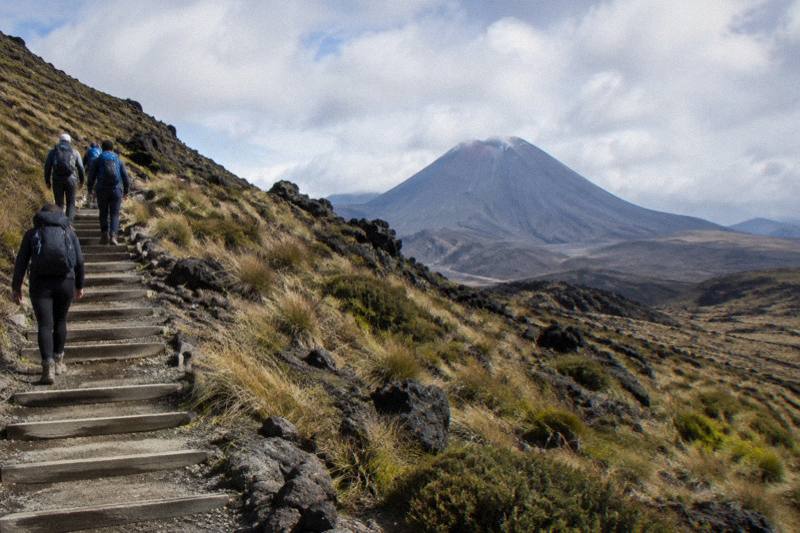
Can You Hike To Mount Doom On The Tongariro Alpine Crossing?
Mount Doom is the popular nickname for Mount Ngauruhoe, which stands beside the Tongariro Alpine Crossing. Here is what you can actually hike, and which tours and shuttles get you there.
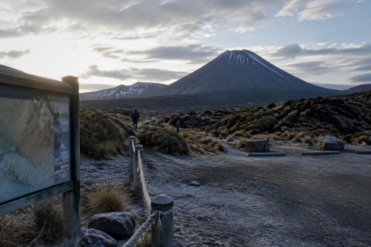
No tour or shuttle climbs Mount Doom. Mount Doom is the popular nickname for Mount Ngauruhoe, the volcanic cone that stands beside the Tongariro Alpine Crossing, and every product sold here walks the Crossing itself, a 20.2 km one-way track from Mangatepopo to Ketetahi Road, rather than ascending the peak. The Crossing gives you sustained, close-up views of Ngauruhoe from the South Crater plateau and the Red Crater ridge, which is what most people actually mean when they ask the question. For a full breakdown of what guided trips actually cover and what they cost, the guide to Mount Doom hikes and Tongariro Crossing tours compares the options side by side.
That gap between what people ask for and what exists is worth naming honestly, because it shapes every booking decision on this page. A reader searching for a Mount Doom hike is really choosing a Tongariro Alpine Crossing tour: a guided hike, a shuttle from one of the departure towns, or a park-and-ride at the Ketetahi end. The cone you saw in the films is scenery on that walk, not a destination the track reaches. DOC, which manages the national park, grades the Crossing as an Intermediate tramping track in summer and an Expert route from May to October, with a fitness requirement of High and a walking time of 7 to 8 hours between November and April.
The nickname itself is fine to use in passing, and plenty of walkers do. Locals and visitors alike call it Mount Doom, and this page uses both names. What the site's own voice will not claim is any filming history, only that the stark, blackened landscape around the mountain is often described as having a Mordor look, which it genuinely does, particularly across the lava fields of the Mangatepopo Valley in early morning light.
If your goal is the Crossing walk with Ngauruhoe in view, three products cover the main ways to do it: a round-trip shuttle, a fully guided hike, and a one-way park-and-ride. These are the natural starting points.
“Great shuttle service, easy to use and great secure parking. Friendly staff. Thank you! Bus was full! Book your spot!”
What Is Mount Doom On The Tongariro Alpine Crossing?
Mount Doom is the popular nickname for Mount Ngauruhoe, an active volcanic cone that rises beside the Tongariro Alpine Crossing track rather than on it. The Crossing climbs to Red Crater at 1886 m, the track's highest point, and traverses the South Crater plateau directly below Ngauruhoe's slopes, so the peak is a constant presence for the middle third of the walk. It is scenery, not a summit the track reaches.
Ngauruhoe sits within the Tongariro volcanic complex, inside a dual World Heritage area that is New Zealand's oldest national park, established in 1894. The mountains are sacred to Ngati Hikairo ki Tongariro of Ngati Tuwharetoa, who are kaitiaki, or guardians, of the maunga. That cultural weight matters to how the track is walked, and it comes up again further down this page in the section on respecting the waterways. For now, the practical point is that the Crossing is the designed route through this landscape, and it was laid out to cross Tongariro itself, passing Red Crater, the Emerald Lakes and Blue Lake, with Ngauruhoe standing to the side.
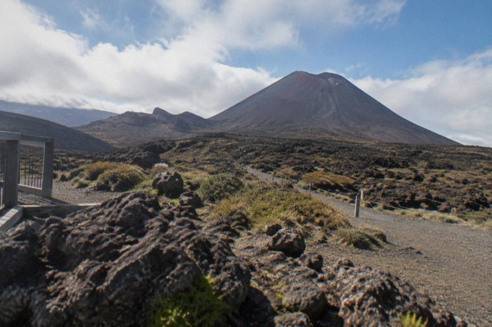
The shape of the walk explains where the views come from. The track starts at 1120 m at Mangatepopo, follows a boardwalk up the valley, then climbs around 350 m by staircase to the South Crater plateau. That plateau is the first big Ngauruhoe moment: the cone fills the western sky, close enough to see scree channels and old lava flows on its flanks. From there the track ascends the ridge to Red Crater, and on a clear day the view back over South Crater to Ngauruhoe is one of the signature photographs of the entire 20.2 km. DOC notes that loose rock on Red Crater is a major slip hazard, so the climb calls for care underfoot, while the plateau and the ridge rest stops leave room to pause and take in the view.
Beyond Red Crater, the track turns away from Ngauruhoe and descends steep scree to the Emerald Lakes, passes Blue Lake, then zig-zags down the northern slopes with views over Lake Rotoaira and Lake Taupo before finishing in forest at Ketetahi Road, 760 m. The Ngauruhoe section of the day, in other words, is the middle block between the staircase and the Red Crater rim, roughly the most physically demanding two hours of the walk. Anyone booking specifically for the mountain should know that cloud can sit on the plateau even when the start and finish are clear, which is why the weather section of this site deserves a read before you commit to a date.
How Close Does The Tongariro Alpine Crossing Get To Mount Doom?
The track crosses the South Crater plateau directly beneath Ngauruhoe and climbs the adjacent ridge to Red Crater at 1886 m, passing within sight of the cone's lower slopes for roughly the middle third of the 20.2 km route. It never touches the peak itself, and no section of the official track branches off toward it.
The closest moments come in sequence. First is the climb out of Mangatepopo Valley, where the cone first appears ahead of you, framed by the dark lava fields. Second is the South Crater plateau itself, a flat, moonswept expanse where Ngauruhoe stands at its most dominant; many walkers describe this stretch, with some justification, as the Mordor look, all black volcanic gravel and steam, though this site makes no claims about what was filmed where. Third is the ridge between South Crater and Red Crater, where you look back at the cone from above the plateau, and then the Red Crater rim, the highest point of the day, where the final full-profile view of Ngauruhoe sits behind you over South Crater.
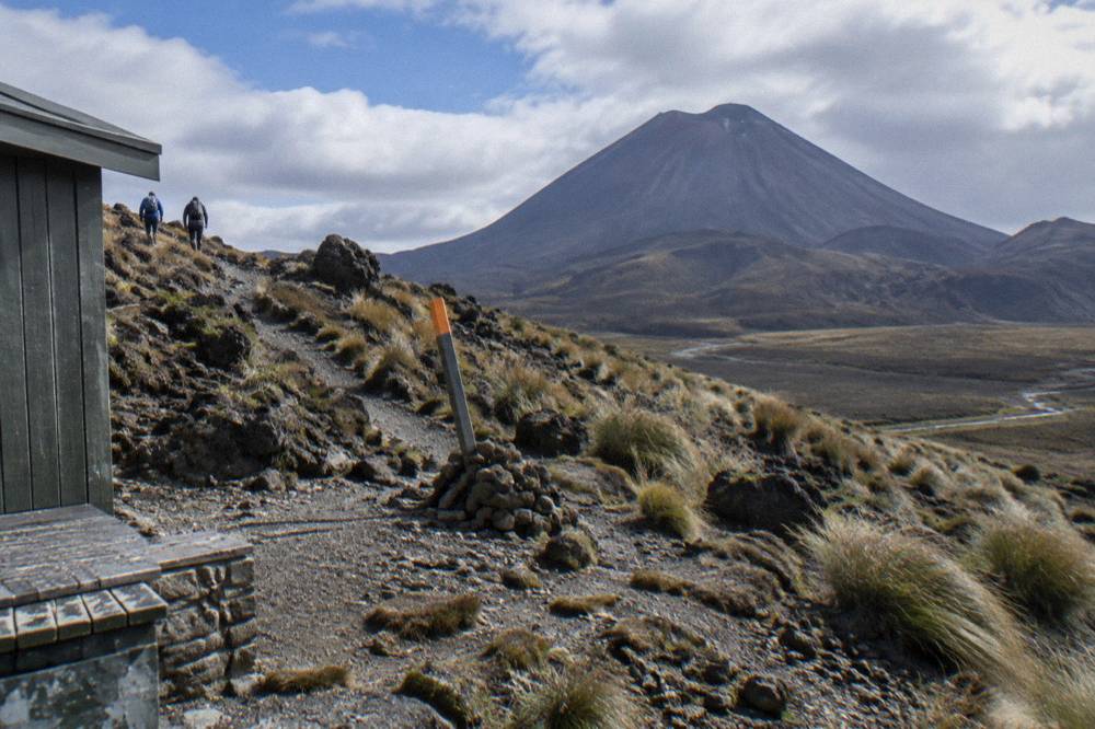
Time on the track matters here. DOC's walking time of 7 to 8 hours from November to April covers the whole one-way distance, and the Ngauruhoe-facing stretch occupies a meaningful slice of it: the staircase, the plateau crossing, and the Red Crater ascent together are the climb from 1120 m at the start to 1886 m at the rim, with an overall elevation change of plus and minus 1196 m across the day. After Red Crater the track falls away steadily to the finish at 760 m. That profile is why DOC grades fitness as High, why the descent's many steps trouble weaker knees, and why shuttle operators plan a full day around the walk; the round-trip products on this site list total booked durations of about 8 hours, which is the whole day including transport, not walking time.
One more planning fact from DOC: the first 5.4 km of the Crossing is shared with the Soda Springs Walk, an easy two-hour return option. Walkers who are not confident about the harder sections sometimes use that shorter walk instead, and it also delivers valley-floor views of Ngauruhoe, though from lower down and further away than the plateau. It is a genuine fallback for a family member who wants the mountain scenery without the full commitment.
Can You Climb Mount Ngauruhoe From The Tongariro Alpine Crossing?
No product sold on this site climbs Ngauruhoe. Every tour, guided hike and shuttle here travels the official Crossing track only, and none offers a summit ascent, so there is no summit distance, time or price to compare. The guided walks follow the marked route past Red Crater and the lakes, and the shuttles exist purely to move walkers between towns and the track ends.
That answer is stated plainly because search results sometimes blur the line between the Crossing and the volcano beside it. The three guided tours are the Adrift Tongariro premium guided Crossing hike, from $253 per person, rated 4.6 across 241 reviews; the Adrift Tongariro half-day guided walk, from $197 per person, rated 4.7 across 27 reviews, which is a shorter walk and explicitly not the full Crossing; and the Adrift Tongariro private guided Crossing, from $774.01, rated 4.5 across 30 reviews. Two cover the full Crossing; the half-day is a shorter guided walk, and all three meet at the Adrift base at 53 Carroll Street, National Park Village, with return transport included and a guide throughout. None of them, and none of the thirteen shuttle products, turns off toward the peak.
The distinction matters for expectations. A guided Crossing hike gives you alpine knowledge, winter equipment when conditions require it, and the security of a group on a track DOC itself summarises bluntly for winter: crampons, ice axe and helmet are essential, as is competency using them, and DOC's advice for the May-to-October season is simply "go with a guide". On the three Adrift tours, crampons and ice axes are supplied for winter conditions if required, along with a clothing and footwear allowance, and lunch is not included, so bring your own. Minimum age is 12 on the premium and private guided tours, with a group maximum of 60 on the premium hike. The premium and half-day tours can be cancelled free up to 14 days in advance; the private Crossing is non-refundable, so the booking page's cancellation terms deserve a careful read before you commit.
For a fuller comparison of walking with a guide versus going independently, the companion piece on hiking the Crossing without a guide works through the trade-offs, and the guide page on choosing between the Ngauruhoe climb and a Crossing tour covers the same choice at more length.
Which Tongariro Crossing Tour Gives The Best Mount Doom Views?
The views of Ngauruhoe come from the track, not from the tour, so any product that walks the full Crossing delivers the same plateau and Red Crater vantage points. The choice between them is about how you get there: a guided hike with transport and equipment included from $253, a round-trip shuttle from $42, or a one-way park-and-ride from $34. All finish the same walk with the same views, conditions allowing.
The Tongariro Crossing Shuttles round trip from National Park Village runs from $42 per person and is rated 4.7 across 886 reviews. It is a shuttle, not a guided walk: you board at the Park n Ride at 59 Findlay Street, National Park Village, in the morning for the run to the track start, and the same ticket covers the afternoon pickup from Ketetahi. Free cancellation applies up to 24 hours in advance. For a walker whose priority is the Ngauruhoe panorama and who is comfortable on the marked track alone, it is the straightforward option, and National Park Village sits 13.5 km from the track by DOC's distance table, the closest of the shuttle towns after Whakapapa.
The guided alternative changes the character of the day. The Adrift Tongariro premium guided Crossing hike, from $253 per person and rated 4.6 across 241 reviews, runs 8 to 9 hours door to track to door, includes return transport from the base at 53 Carroll Street, and puts a guide with you across the plateau and up Red Crater, which is exactly the terrain where the Ngauruhoe views are concentrated. Hotel pickup is not included, so you make your own way to the base. In winter this becomes more than a comfort: DOC's own guidance for the season is to go with a guide, and the supplied crampons and ice axes matter when the track becomes an Expert route with 9 hours of walking in 9 to 11 hours of daylight.
The budget and flexibility option is the park-and-ride at the Ketetahi end. The Ruapehu Scenic Shuttles Ketetahi park-and-ride, from $38 per person and rated 4.8 across 665 reviews, is a one-way shuttle: you park at the Ketetahi Road end, ride to Mangatepopo, and walk the Crossing back to your own car, with no return leg to wait for. Five other operators run the same one-way format, including the cheapest per-person tour on this site, the Active Outdoor Adventures one-way shuttle with a secure Ketetahi car park, from $34. One-way park-and-rides are shuttles, not guided walks, and they suit walkers who want to finish at their own vehicle with no afternoon timetable.
How Do You Get To The Tongariro Alpine Crossing Track Start?
DOC's position is that the best way to the Crossing is by shuttle, because summer parking at the road ends is restricted to a 4-hour maximum from Labour weekend in late October to 30 April, and there is no summer parking for Crossing walkers at Mangatepopo car park at all. This site covers 17 tours and shuttles across 5 categories, departing from 6 points: National Park Village, the Ketetahi car park, Taupo, Turangi, Ohakune and Auckland.
The shuttle choice follows your base town. From National Park Village, the round-trip options are the Tongariro Crossing Shuttles service described above and the Dempsey Buses round-trip shuttle, from $51 per person, rated 4.8 across 72 reviews, which uses pickup points in National Park Village and excludes children under 6. From Taupo, the Tongariro Expeditions family of products covers several options, from $42 per person and rated 4.7 across 429 reviews, including a dedicated Taupo return shuttle from $80.27 per person with a group maximum of 24. From Turangi, the Backyard Tours round-trip transfer runs from $51.60 per person, rated 4.9 across 76 reviews, from the operator's base on Te Rangitautahanga Road. From Ohakune, the Dempsey Buses return shuttle runs from $62 per person, rated 4.8 across 19 reviews.
| Departure point | Product | Format | From price (USD) | Rating and reviews |
|---|---|---|---|---|
| National Park Village | Tongariro Crossing Shuttles round trip | Shuttle, round trip | $42 per person | 4.7, 886 reviews |
| National Park Village | Adrift premium guided Crossing hike | Guided hike with return transport | $253 per person | 4.6, 241 reviews |
| Ketetahi Road end | Ruapehu Scenic Shuttles park-and-ride | Shuttle, one-way | $38 per person | 4.8, 665 reviews |
| Taupo | Tongariro Expeditions Taupo return shuttle | Shuttle, round trip | $80.27 per person | 4.5, 25 reviews |
| Turangi | Backyard Tours round-trip transfer | Shuttle, round trip | $51.60 per person | 4.9, 76 reviews |
| Ohakune | Dempsey Buses return shuttle | Shuttle, round trip | $62 per person | 4.8, 19 reviews |
Two DOC rules sit behind all of this. First, the free track booking system introduced in October 2023 is recommended for every walker and is required to use a shuttle or guided walk service; there is no cost, no penalty for arriving without one, and the guide or shuttle operator may make the booking for you. Show the receipt to rangers at the carpark. Second, DOC does not recommend parking on State Highway sides, and the 4-hour summer maximum at the road ends makes all-day self-parking at Mangatepopo a non-starter. There is a private car park near the Ketetahi end, which is what the six park-and-ride products are built around.
Distances from the track, per DOC: Whakapapa 10.4 km, National Park 13.5 km, Turangi 36.7 km, Ohakune 48 km, Taupo 86.5 km. Auckland is a long way, and the two Auckland products reflect that. The Kiwi Road Tours private transfer from Auckland, from $338, is transport only: the walk is self-guided and the Crossing shuttle costs extra. The ExperienceKart private three-day tour from Auckland, from $3,150.50, includes the Crossing as one self-guided leg among Waitomo, Huka Falls and Lake Taupo stops. Neither is a guided Crossing tour. The site's guide to getting from Auckland to the Crossing covers both in detail, and the question of the best shuttle for the Crossing has its own comparison page.
“Fantastic day! We had stunning weather for the crossing, incredible experience. The shuttle was brilliant and made the whole day run smoothly, thank you!”
What Should You Know About The Sacred Mountains Around The Crossing?
Ngati Hikairo ki Tongariro of Ngati Tuwharetoa are kaitiaki of the mountains, and their kaumātua asks visitors to respect the sanctity of the maunga tapu by not touching or entering any of the waterways, including the alpine lakes. The Emerald Lakes and Blue Lake you pass below Ngauruhoe are part of that request, which DOC prints on the track's own pages.
The request is specific and easy to honour on a walk that passes three alpine lakes in succession. The Emerald Lakes sit in the blast bowl below Red Crater, steaming and impossibly coloured, and Blue Lake, Te Wai Whakaata o Te Rangihīroa, follows on the high plateau beyond. Geothermal features run through this landscape: DOC warns walkers not to approach the fumaroles near the Emerald Lakes and not to touch or enter any lake. The same section of track passes the Red Crater vent zone itself, part of an active volcanic area in which, as DOC notes, eruptions can occur at any time, with a 3 km hazard radius around each of the three Tongariro vents; the most recent eruption was from Te Maari in 2012.
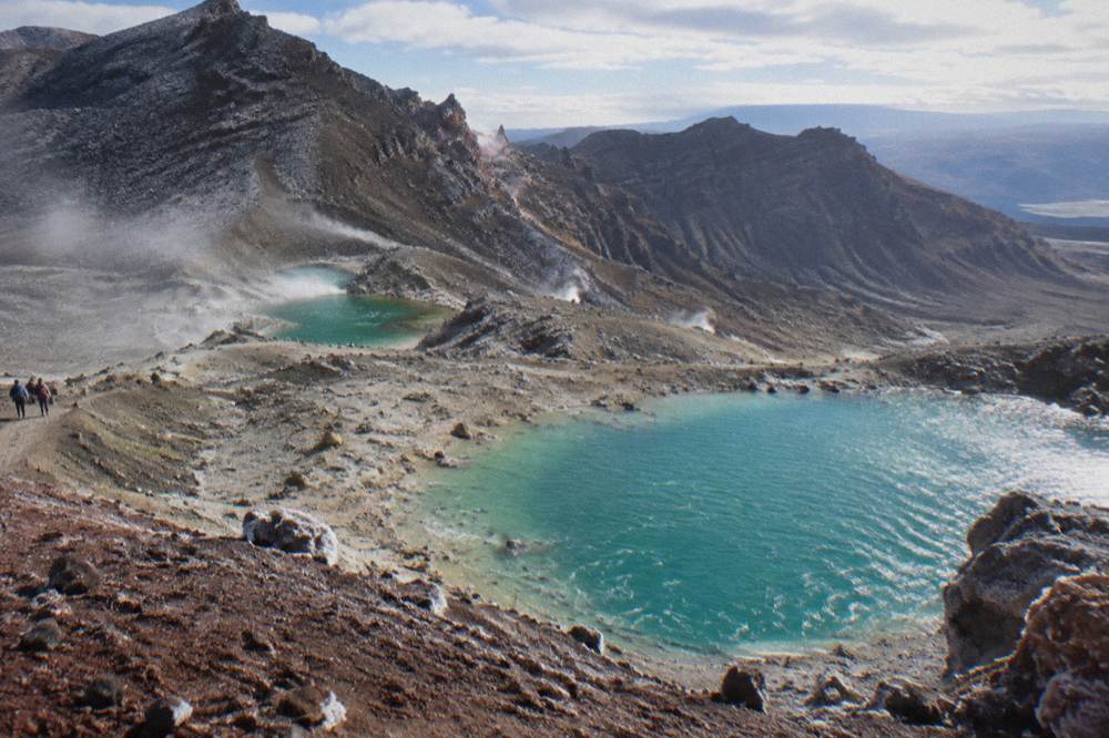
There is a second, newer layer to the landscape. Two fires in late 2025 burned significant areas of the park around the start of the Crossing, leaving blackened ground now regrowing, and the hapū placed a 10-year restorative rāhui over the affected area. DOC's framing, in the words of spokesperson Te Ngaehe Wanikau, is that the rāhui is "not about keeping people out": visitors are asked to stay on the tracks, keep out of fire-affected areas off track, clean shoes and gear, and take rubbish home. Manaaki Rangers greet walkers daily from November to April at the track start and share traditional stories, which is a good moment to hear the mountain's own account of itself rather than only the film-derived one.
That cultural framing is also why this site is careful about the Mount Doom framing. The nickname is popular and harmless in conversation, but the mountain's name is Ngauruhoe, it is sacred alongside Tongariro and Ruapehu, and Ngati Tuwharetoa made the heart of the mountains sacrosanct in 1887 before gifting them into what became, in 1894, New Zealand's first national park and eventually a dual World Heritage area, the first property inscribed under the revised cultural landscape criteria in 1993. Walking it with those facts in mind changes the plateau from a film set into what it actually is.
When Is The Best Time To Walk The Tongariro Crossing For Ngauruhoe Views?
The summer season from November to April carries the full shuttle network and the 7-to-8-hour walking window, and Manaaki Rangers are present daily in those months. Winter, May to late October, turns the track into an Expert route with 9 hours of walking in 9 to 11 hours of daylight, and DOC's advice for that season is to go with a guide. No season guarantees views.
The seasonal mechanics are worth understanding before you pick a date. Summer brings the parking restrictions and the shuttle timetables, along with the advisory system: DOC assesses conditions each morning and posts a Not Recommended Today advisory at the track start when the Red Crater forecast crosses defined wind, wind-chill or precipitation thresholds. The advisory is advice, not a closure or an operating ban. A Hazardous Weather Warning is different: as part of their concessions, all operators have agreed not to run when one is issued. Winter removes the shuttle network almost entirely, per DOC's note that shuttle buses generally do not operate from May to late October while guided trips include transport, and it demands crampons, ice axe and helmet, avalanche equipment for independent trips, and the competency to use all of it. DOC's temperature rule makes the point vividly: on a calm day, Red Crater is at least 10 °C colder than Taupo and 5 °C colder than the track start, and you subtract another 2 °C for every 10 km/h of wind. Cloud on the plateau can hide Ngauruhoe even on a day that starts clear at the road end, so views are conditions allowing rather than promised. The current forecast sits on DOC's Tongariro Alpine Crossing page and the NIWA Red Crater forecast.
For a Mount Doom-focused walker, the practical read is this. Book the summer season for the shuttle choice, the longer daylight and the intermediate track grading. Book a guided hike if you want the winter experience or the alpine support, accepting that the premium guided tour is from $253 per person against $42 for the most reviewed round-trip shuttle. Either way, check the forecast the day before, aim for an early start, and be ready for the plateau to be in cloud. The mountain is not going anywhere; it has been the backdrop to this walk for as long as the track has existed, and a second attempt on another day is a better plan than a risky one.
If you are weighing the seasons, the site's month-by-month guide to the best month for the Crossing works through the trade-offs, and the winter guided tour guide covers the May-to-October experience in full.
Common Questions About Hiking Mount Doom On The Tongariro Alpine Crossing
Can You Hike To Mount Doom On The Tongariro Alpine Crossing?
No. Mount Doom is the popular nickname for Mount Ngauruhoe, which stands beside the Crossing rather than on it. The Crossing is the 20.2 km official track from Mangatepopo to Ketetahi Road, passing below the cone on the South Crater plateau and beside it on the Red Crater ridge. No product climbs the peak, and there is no summit ascent to book.
Can You See Mount Doom From The Tongariro Alpine Crossing?
Yes, and from close range. The track crosses the South Crater plateau directly beneath Ngauruhoe and climbs the adjacent ridge to Red Crater at 1886 m, giving sustained views of the cone across roughly the middle third of the walk. Cloud can sit on the plateau even when the track ends are clear, so views are conditions allowing rather than guaranteed.
Is The Tongariro Alpine Crossing The Same As The Mount Doom Hike?
No. The Crossing is a one-way 20.2 km track over Tongariro itself, graded Intermediate in summer with a 7-to-8-hour walking time. Ngauruhoe is a separate peak beside the track, and the track never ascends it. People who ask for a Mount Doom hike are almost always best served by a Crossing tour or shuttle.
Which Tour Is The Cheapest Way To Walk Past Mount Doom?
The cheapest per-person tour on this site is the Active Outdoor Adventures one-way shuttle with a secure Ketetahi car park, from $34, followed by the National Park Shuttles one-way at $34.40 and the Ruapehu Scenic Shuttles and Owhango Adventures park-and-rides at $38. The cheapest guided walk is the Adrift Tongariro half-day guided walk at $197 per person, which is a shorter walk and not the full Crossing.
Do You Need A Booking To Walk The Tongariro Alpine Crossing?
DOC's track booking system, introduced in October 2023, is free and recommended for every walker, and it is required to use a shuttle or guided walk service. Your guide or shuttle operator may make the booking for you, and you show the receipt to rangers at the carpark. There is no penalty for arriving without a booking.
Can Children Walk The Crossing Past Mount Doom?
DOC advises the track is not recommended for children under 10. Operator minimums vary by product: the Adrift premium and private guided tours and the ExperienceKart three-day tour require a minimum age of 12, the National Park Shuttles one-way requires 8, and both Dempsey Buses shuttles exclude children under 6. Check the specific tour's booking page for the rule that applies to it.
The short version of this whole page: the walk you are imagining when you say Mount Doom is the Tongariro Alpine Crossing itself, and it is a spectacular one. Tongariro Alpine Crossing Tours compares every way of doing it, from the $34 one-way park-and-rides to the fully guided hikes that run all winter, so pick the format that matches your fitness, your season and your appetite for alpine terrain, and let Ngauruhoe look after the backdrop.