Mount Doom Hike: Tongariro Crossing Tours Through The Mordor Landscape
Mount Doom is the popular nickname for Mount Ngauruhoe, and no tour climbs it. Here is what Tongariro Crossing tours actually cover of the volcanic Mordor landscape, with prices and facts.
Short answer
Mount Doom is the popular nickname for Mount Ngauruhoe. No tour on this site climbs it, and the crossing of the volcanic plateau beside it is a 20.2 km one-way walk taking 7 to 8 hours from November to April. Guided crossings run from $253 per person, one-way shuttles from $34.
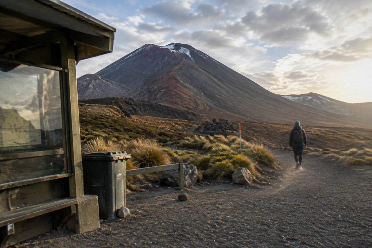
Mount Doom is the popular nickname for Mount Ngauruhoe, the near-perfect volcanic cone that stands beside the Tongariro Alpine Crossing for much of its length. It earned the nickname through the Mordor look of the surrounding landscape, black lava fields and red scorched slopes under a smoking sky. No tour sold on this site climbs the mountain: the crossing track itself is the closest a booked product gets, and it helps to know that before any money changes hands. For the full picture on how close hikers can legally get to the crater and which shuttles serve the trailheads, the guide to hiking Mount Doom on the Tongariro Alpine Crossing covers the practical details.
What the track does deliver is the landscape around it. The Tongariro Alpine Crossing is a 20.2 km one-way walk from Mangatepopo Valley to Ketetahi Road, climbing to Red Crater at 1886 m, passing the Emerald Lakes and Blue Lake, and crossing terrain that the Department of Conservation (DOC) describes as an active volcanic area, with a 3 km hazard radius around each of the three Tongariro vents. This guide sets out what guided and shuttle tours actually cover, what they cost, and how to choose between them. If standing on the summit itself is the goal, the comparison of Ngauruhoe climbs and Tongariro Crossing tours covers how close each option actually gets to the cone.
What Is The Mount Doom Hike In New Zealand?
The Mount Doom hike that most people end up booking is the Tongariro Alpine Crossing, a 20.2 km one-way alpine walk across the volcanic plateau immediately north of Mount Ngauruhoe, rated High fitness by DOC and taking 7 to 8 hours between November and April. The Crossing track never summits Ngauruhoe; it passes along its northern flanks.
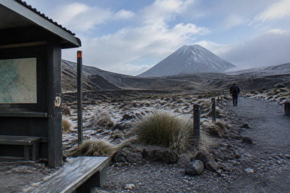
Ngauruhoe is sacred ground as well as scenery. DOC records that the mountains are sacred to Ngati Hikairo ki Tongariro of Ngati Tuwharetoa, guardians of the maunga, and that the park, New Zealand's oldest, dates to 1894 and carries dual World Heritage status. In 1887, Ngati Tuwharetoa made the heart of the mountains sacrosanct. DOC passes on a cultural request from kaumātua Te Ngaehe Wanikau: visitors are asked to respect the sanctity of the maunga tapu (sacred mountains) by not touching or entering any of the waterways, including the alpine lakes.
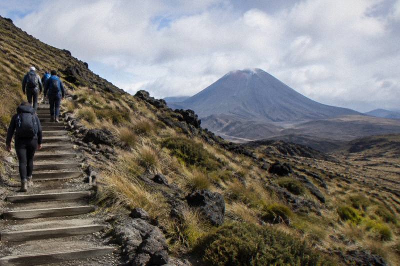
So the honest framing for a "Mount Doom nz" search is a reframing. The thing being bought is a crossing of the volcanic plateau: the Mangatepopo Valley boardwalks, the roughly 350 m staircase climb to South Crater, the ridge up Red Crater, and the long descent past steaming vents to forest at the Ketetahi end. Ngauruhoe stands beside all of it as one of the most photographed cones in the country. If a summit scramble is the fixed goal, no product here sells one, and this guide will not invent a distance, a time or advice for it.
The landscape carries its own recent history too. DOC reports that two fires in late 2025 burned significant areas of the park around the start of the Crossing, leaving blackened ground now regrowing, and that hapū Ngati Hikairo ki Tongariro placed a 10-year restorative rāhui over the affected area. The rāhui, as DOC's spokesperson put it, is "not about keeping people out": visitors are asked to stay on the tracks, keep off fire-affected ground, clean shoes and gear, and take rubbish home.
Can You Actually Climb Mount Doom On A Tongariro Crossing Tour?
No. DOC's track page describes the route and its hazards; it lists no Ngauruhoe ascent, and no operator here sells one.
That is not a gap in the market being hidden from you. It is the shape of the track and the culture around it. The Crossing's published statistics are a 20.2 km one-way distance, an elevation gain and loss of plus and minus 1196 m, a start at 1120 m in Mangatepopo Valley, a high point of 1886 m at Red Crater, and a finish near 760 m at Ketetahi Road. Walking time is 7 to 8 hours from November to April and about 9 hours through the winter months of May to October, when DOC reclassifies the track from an Intermediate tramping track to an Expert route.
Two product families exist here, and they are genuinely different things. A guided crossing puts a guide with you, includes round-trip transport from the operator's base, and on the three Adrift Tongariro tours supplies crampons and ice axes for winter conditions along with a clothing and footwear allowance. A shuttle gets you and your legs to the right end of the track and back, with no guide, and that distinction is not marketing: a shuttle is never guided, and the one-way park-and-ride options include no return leg at all, because you walk back to your own car.
The selection above spans the three decisions most readers face: the straightforward round-trip shuttle, the fully guided day, and the park-at-Ketetahi one-way format. Each is covered in detail below with its own figures, so you can match the format to your budget and confidence rather than paying for a guided product you do not need.
Which Tongariro Crossing Tours Pass Closest To Mount Doom?
All of them, because the whole track runs along the northern edge of the massif: the three Adrift Tongariro guided tours and every shuttle deliver walkers to Mangatepopo or Ketetahi, between which the Crossing passes South Crater and Red Crater with Ngauruhoe in view for much of the day. The difference between tours is guidance, transport and price, not scenery.
Adrift Tongariro runs the three guided tours on this site. The premium guided hike is a full Crossing day of 8 to 9 hours door to door, rated 4.6 across 241 reviews, from $253 per person, with return transport from the base at 53 Carroll Street, National Park Village, crampons and ice axes supplied for winter conditions if required, a group cap of 60, a minimum age of 12, and free cancellation up to 14 days ahead. Bring your own lunch; it is not included, and hotel pickup is not either. The half-day guided walk, from $197 per person and rated 4.7 across 27 reviews, is a shorter guided walk and explicitly not the full Crossing. The private guided Crossing, from $774.01, is non-refundable and its price basis is shown on the booking page, so read the terms carefully before booking.
Guidance earns its price on this track in ways that are easy to underestimate from a distance. DOC's own winter guidance says the track demands people who can navigate when cloud or snow hides the marker poles, prevent a slide on ice, and survive worsening weather, and its short summary for the under-equipped is "go with a guide". Even in summer the loose scree on Red Crater is a documented major slip hazard, and DOC attributes 38 percent of tramping injuries to slipping. A guide or shuttle operator may handle the free track booking that DOC requires for anyone using a shuttle or guided service, though you can make it yourself in minutes.
| Tour | Format | From price | Rating |
|---|---|---|---|
| Adrift premium guided Crossing | Guided full Crossing, transport round trip | $253 per person | 4.6, 241 reviews |
| Adrift half-day guided walk | Guided short walk, not the full Crossing | $197 per person | 4.7, 27 reviews |
| Adrift private guided Crossing | Guided private day | $774.01, price basis on the booking page | 4.5, 30 reviews |
| Tongariro Crossing Shuttles round trip | Shuttle only, round trip, National Park Village | $42 per person | 4.7, 886 reviews |
| Ruapehu Scenic Shuttles park-and-ride | Shuttle only, one way from Ketetahi | $38 per person | 4.8, 665 reviews |
On the shuttle side, the Tongariro Crossing Shuttles round trip from National Park Village is the most reviewed tour here, 4.7 across 886 reviews, from $42 per person, collecting from the Park n Ride at 59 Findlay Street in the morning and returning from Ketetahi in the afternoon, with free cancellation up to 24 hours ahead. It is a shuttle, not a guided walk, and it repeats a point worth making plainly: the track, the weather and the navigation are yours alone on any shuttle product.
How Much Does A Mount Doom Landscape Tour Cost?
One-way shuttles with parking at Ketetahi start at $34 per person, round-trip shuttles from nearby villages run $42 to $62 per person, the guided half-day walk costs from $197 per person, and the guided full Crossing from $253 per person, with the private guided day at $774.01 and multi-day and Auckland products priced separately.
| Shuttle product | Format | From price | Rating |
|---|---|---|---|
| Active Outdoor Adventures Ketetahi park-and-ride | One way, secure Ketetahi car park | $34 per person | 4.1, 81 reviews |
| National Park Shuttles one-way | One way, private Ketetahi car park | $34.40 per person | 4.7, 73 reviews |
| Ruapehu Scenic Shuttles park-and-ride | One way, Ketetahi Road end | $38 per person | 4.8, 665 reviews |
| Owhango Adventures park-and-ride | One way, Ketetahi Road end | $38 per person | 4.8, 312 reviews |
| Tongariro Crossing Shuttles round trip | Round trip, National Park Village | $42 per person | 4.7, 886 reviews |
| Backyard Tours Turangi round trip | Round trip, Turangi base | $51.60 per person | 4.9, 76 reviews |
| Dempsey Buses Ohakune return | Round trip, Ohakune | $62 per person | 4.8, 19 reviews |
| Tongariro Expeditions Taupo return | Round trip, Taupo | $80.27 per person | 4.5, 25 reviews |
The cheapest way onto the track here is the Active Outdoor Adventures one-way shuttle with a secure Ketetahi car park, from $34 per person. Park-and-ride logic is simple: you leave your car at the Ketetahi end, ride to Mangatepopo, and the track finishes back at your own vehicle, so no return leg is needed or included. DOC's parking rules make that format attractive in summer, because from Labour weekend in late October to 30 April a 4-hour maximum applies at both road ends, and DOC says there is no parking at Mangatepopo car park for Crossing walkers in summer at all, only a private car park near Ketetahi.
Beyond the track day itself, budget for the things the fares do not cover. The track booking itself is free, DOC has recommended it for everyone since October 2023 and requires it for shuttle and guided users, and there is no penalty for arriving without one. Track water is not drinkable, so DOC says to carry 2 to 3 litres. Lunch is excluded on the guided tours, bring your own. And DOC notes that part of a shuttle fee goes to conservation, which is a fair thing to know your money is doing. For a fuller cost breakdown, the Tongariro Crossing cost guide works through the sums.
Two Auckland-area products sit outside the per-person comparisons and should not be price-shopped against shuttles. The Kiwi Road Tours private transfer from Auckland, from $338, is a private transfer in which the Crossing shuttle is excluded and the walk is self-guided. The ExperienceKart private three-day tour from Auckland, from $3,150.50, is a private multi-day itinerary in which the Crossing is one self-guided leg among Waitomo, Huka Falls and Lake Taupo stops, and it is non-refundable and not suitable for children under 12. Neither is a guided Crossing tour, and the Auckland to Tongariro guide covers that decision honestly.
What Will You Actually See On The Crossing?
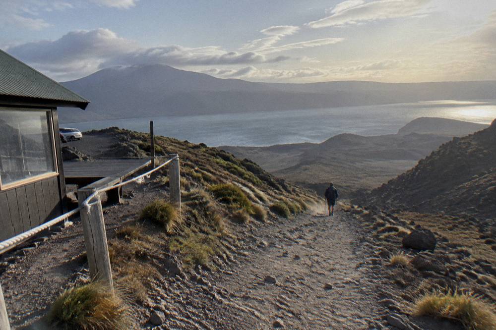
The route DOC describes runs from the Mangatepopo Valley boardwalk, up about 350 m of staircase to the South Crater plateau, to the Red Crater summit ridge at 1886 m, then down steep scree to the Emerald Lakes, past Blue Lake, and down a long zig-zag descent with views over Lake Rotoaira and Lake Taupo to forest and the Ketetahi Road end at 760 m. Ngauruhoe presides over the first half.
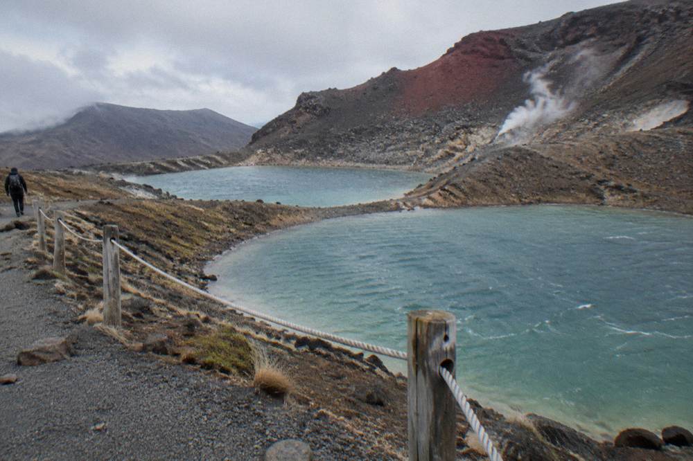
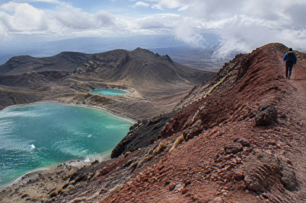
The Emerald Lakes, Ngā Rotopounamu, sit in a blast zone of red and black scoria immediately below Red Crater, steaming gently from fumaroles that DOC warns visitors not to approach. Beyond them, Blue Lake, Te Wai Whakaata o Te Rangihīroa, sits slightly off the main line. The cultural request applies to all of these: do not touch or enter any of the lakes or waterways. The landscape is active, too, not dormant scenery. DOC states the track traverses an active volcanic area, that eruptions can occur at any time although unlikely, and that the most recent eruption was from Te Maari in 2012. If volcanic unrest rises at Tongariro or Ngauruhoe, sections or the whole track close, and status is published by GeoNet rather than by tour operators.
The first 5.4 km shares its line with the Soda Springs Walk, an easy 2-hour return option that serves as a genuine fallback for anyone who reaches the valley and realises the day is beyond them, and it is worth knowing that exit exists before you commit. Toilets sit every 1 to 2 hours along the track, and DOC notes that if there is a queue at Mangatepopo, the next toilets are 1 km, about 20 minutes, up the valley. For a fuller section-by-section account of the staircase and the craters, the Red Crater and Emerald Lakes guided hike guide walks the whole line.
When Is The Best Time Of Year To Walk Beside Mount Doom?
DOC's summer season, November to April, is when the track is an Intermediate tramping track, walking time 7 to 8 hours, shuttles run and Manaaki Rangers greet walkers daily; from May to late October it becomes an Expert route on snow and ice, taking about 9 hours within 9 to 11 hours of daylight, and shuttle buses generally do not operate, while guided trips include transport.
| Season | Track status | Walking time | Transport reality |
|---|---|---|---|
| November to April | Intermediate tramping track | 7 to 8 hours | Shuttles run; 4-hour parking maximum at road ends |
| May to late October | Expert route, snow and ice | About 9 hours | Shuttles generally do not operate; guided trips include transport |
Winter changes the character of the day completely. DOC's gear list for the cold months adds crampons, ice axe and helmet, which it calls essential along with competency using them, plus an avalanche transceiver, probe and shovel for independent trips, a PLB, head torch with spare batteries, and map, compass or GPS. On a calm day Red Crater is at least 10 °C colder than Taupo and 5 °C colder than the track start, and DOC's rule of thumb is to subtract another 2 °C for every 10 km/h of wind. The three Adrift guided tours run in both seasons and supply crampons and ice axes for winter conditions if required, which is precisely why a winter booking points toward a guided product. The winter guided tour guide covers the cold-season decision in full.
Summer has its own gate: the weather advisory system. On summer days, an advisory is applied if the NIWA Red Crater forecast shows, over any two hours between 9 am and 5 pm, average wind of 55 kph or more, gusts of 70 kph or more, wind chill of -10 °C or colder, wind chill of 0 °C or colder with 1 mm or more of precipitation, rain of 2.5 mm per hour or more, snow of 0.1 cm per hour or more, or 10 mm of precipitation over six hours. It is assessed each morning, and when applied the signage goes up at the Mangatepopo Road end. DOC's advisory is not a ban; operators have agreed, as part of their concessions, not to operate when a Hazardous Weather Warning has been issued, so no tour here promises a clear day; check the forecast yourself at the NIWA Red Crater page and the MetService mountain forecast. No advisories are issued from May to October, which shifts the whole responsibility onto you.
How Hard Is The Tongariro Alpine Crossing?
DOC rates the fitness requirement High, over 20.2 km of steep and undulating track with 1196 m of climb and descent, and advises the walk is not recommended for children under 10; operator age minimums are stricter on some products, at 12 on the Adrift premium and private tours and 8 on the National Park Shuttles one-way.
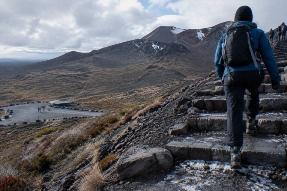
The two sections that decide most people's days are the staircase and the Red Crater descent. The climb to South Crater is roughly 350 m on steps, steady rather than technical, and the descent from Red Crater runs down loose scree that DOC flags as a major slip hazard, followed by many steps on the northern slopes that trouble weaker knees. Boots matter more than pride here: DOC's gear list asks for sturdy boots, waterproof layers, hat, gloves and sunscreen, and a base layer, insulation and shell. If you are weighing footwear honestly, read can you wear sneakers on the Tongariro Crossing before you pack.
A realistic fitness frame is the Soda Springs Walk test: if 5.4 km of easy valley track sounds like enough for the day, the full Crossing probably is not for you this trip. DOC lists two poor-weather alternatives in the area, the Taranaki Falls Walking Track and the Tama Lakes Track, both of which keep you under the mountain without committing you to the alpine section. For walkers set on the full day, the difficulty guide breaks the track into segments with what each demands.
Guided or independent, the decision carries weight because rescue is not a plan. DOC's summary of who the winter track suits names people who can navigate with hidden marker poles, rescue someone in avalanche terrain, prevent a slide and survive worsening weather. In summer the bar is lower but not low, and the same mountain that photographs beautifully will take a hot day, a cold wind and a long descent out of anyone. Whatever you book, check the booking page for the exact cancellation terms. Most shuttle options carry free cancellation up to 24 hours ahead, while the two guided Adrift day tours set their window at 14 days.
Where Should You Book From?
National Park Village, 13.5 km from the track by DOC's distances, anchors the most tour options with five products, while the Ketetahi car park serves six one-way park-and-rides, Taupo 86.5 km away carries two Tongariro Expeditions options, Turangi and Ohakune one each, and Auckland the transfer and multi-day products.
Your base town largely chooses your format for you. Staying in National Park Village puts the round-trip shuttles and the Adrift guided base within reach; the premium and half-day tours meet at 53 Carroll Street, and the round-trip shuttle collects from the Park n Ride at 59 Findlay Street. Staying in Taupo, the Tongariro Expeditions Taupo return shuttle, from $80.27 per person for a 10-hour round trip, is the round-trip option, and its sister product with options from Taupo, Turangi and the Ketetahi end runs from $42 per person, with the operator's stated peak season spanning late October to the end of April. The shuttles by departure town guide maps every option against every base.
Two bookings close this out. One is the track booking itself, free and quick through DOC, required for any shuttle or guided service and recommended for everyone. The other is your seat.
The mountain will still be called Mount Doom by half the people on the track. What you will have booked is the real thing under its own name: Ngauruhoe, sacred, unclimbed by any tour here, and framed properly from a track that DOC, GeoNet and the iwi all take seriously. Plan for the weather, carry your water, keep out of the lakes, and the landscape does the rest. Tongariro Alpine Crossing Tours gathers departure towns, prices and cancellation terms in one place, and the booking page shows the live price and full terms before you book.
Common Questions About Mount Doom And Tongariro Crossing Tours
Can You Hike To Mount Doom On The Tongariro Alpine Crossing?
No. No tour on this site climbs Mount Ngauruhoe, the volcano popularly called Mount Doom, and the Crossing track passes beside it without a summit route. The closest a booked product gets is the guided or shuttle crossing of the volcanic plateau around it. The blog post can you hike to Mount Doom covers the question in detail.
What Is The Mount Doom Hike Actually Called?
The hike people mean is the Tongariro Alpine Crossing, a 20.2 km one-way track from Mangatepopo Valley to Ketetahi Road across New Zealand's oldest national park. Mount Doom is the popular nickname for Mount Ngauruhoe, which stands beside the track as scenery.
How Much Does A Mount Doom Landscape Tour Cost?
One-way shuttles with parking at the Ketetahi end start at $34 per person, round-trip shuttles from nearby villages run $42 to $62 per person, the guided half-day walk costs from $197 per person, and the guided full Crossing from $253 per person. Private and multi-day products are priced separately.
Is A Guided Tour Worth It For The Crossing?
Guidance adds a trained leader, round-trip transport, winter crampon and ice axe supply, and a group cap of up to 60 on the premium tour, from $253 per person. DOC's own advice for the under-equipped is blunt: go with a guide. Confident summer walkers with a shuttle do the same track for $34 to $62.
Can Children Do The Mount Doom Landscape Walk?
DOC advises the track is not recommended for children under 10. Operator rules vary by product: the Adrift premium and private guided tours set a minimum age of 12, National Park Shuttles one-way sets 8, and the Dempsey Buses shuttles exclude children under 6.
Does The Crossing Run In Winter?
Yes, as an Expert route. From May to late October the track crosses snow and ice, takes about 9 hours within 9 to 11 hours of daylight, requires crampons, ice axe and helmet, and shuttle buses generally do not operate, while the guided trips include transport and supply winter gear.