Tongariro Crossing Map: Start, Finish And Where Shuttles Pick Up
The Crossing runs one way, Mangatepopo to Ketetahi Road, and the map decides your shuttle. Here is where every pickup, drop-off and car park sits.
Short answer
The Tongariro Alpine Crossing starts at Mangatepopo (1120 m) and finishes at Ketetahi Road (760 m), 20.2 km one way past Red Crater at 1886 m. Round-trip shuttles pick up at National Park Village, Ohakune, Turangi and Taupo; six one-way park-and-ride services start from car parks at the Ketetahi end, from $34 per person.
The Tongariro Alpine Crossing is a one-way track, and that single fact shapes every transport decision you make. You cannot walk it as a loop, you cannot leave a car all day at the DOC road ends in summer under the four-hour limit, and the shuttle you book determines where your day begins and ends. The Department of Conservation (DOC) measures the track at 20.2 km one way, from Mangatepopo at 1120 m over Red Crater at 1886 m and down to Ketetahi Road at 760 m, with an elevation change of plus and minus 1196 m.
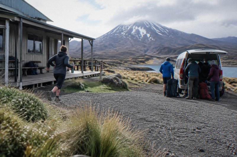
A reader opening the crossing map is really working out one thing: which shuttle drop-off and pickup to book. This guide walks the map from start to finish, then maps every pickup point, park-and-ride and car park the tours on Tongariro Alpine Crossing Tours cover, so you can match the transport to where you are sleeping the night before. It also covers the rules that sit on top of the map: the 4-hour parking maximum, the free track booking and the winter shutdown of most shuttle services.
Where Does The Tongariro Crossing Start And Finish?
The Crossing starts at Mangatepopo, at the head of the Mangatepopo Valley at 1120 m elevation, and finishes at Ketetahi Road at 760 m, on the northern side of the massif. The two ends are connected only by the 20.2 km track itself; there is no road between them, which is why a shuttle or a two-car strategy is unavoidable for almost everyone.
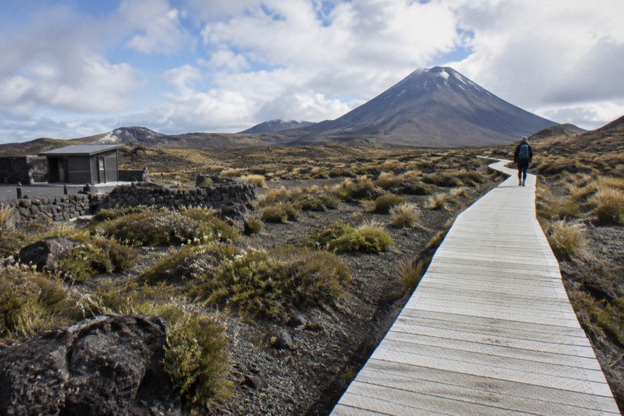
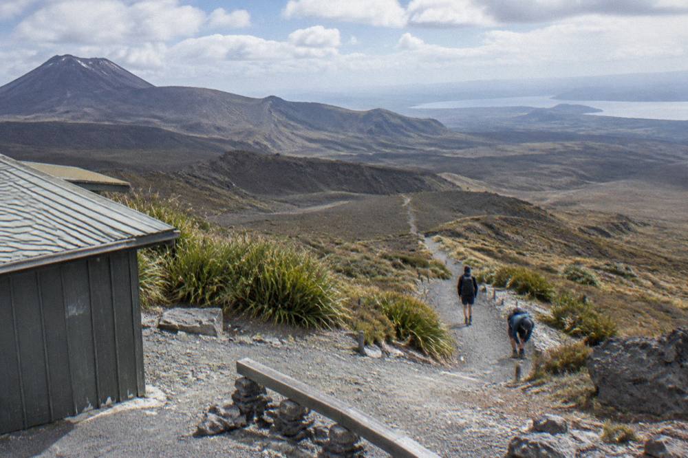
DOC describes the direction of travel as Mangatepopo Valley to Ketetahi Road, and that is the direction the whole shuttle system is built around. Almost every walker, guided or independent, rides to Mangatepopo in the morning and walks north. The climb sequence DOC names runs like this: a boardwalk through Mangatepopo Valley, a steady climb of around 350 m up a staircase to the South Crater plateau, the ascent to Red Crater, a steep scree descent to the Emerald Lakes, then Blue Lake, a long zig-zag descent of the northern slopes with views over Lake Rotoaira and Lake Taupo, and finally forest down to Ketetahi Road.
The start feels gentle and the finish feels long, and the map explains both. The first 5.4 km are shared with the Soda Springs Walk, an easy two-hour return option that DOC points to as a fallback for people without the fitness for the harder parts beyond. The northern descent is where DOC warns that many steps can trouble weaker knees. Knowing the shape of the track helps you judge where you will be at midday, and where your pickup vehicle will be waiting at the end of it.
The two ends also feel nothing alike, which matters when you are planning layers and a pickup. Mangatepopo sits in an open valley at altitude, exposed from the first step, while the Ketetahi end drops through forest on the northern slopes, cooler and greener after the volcanic middle.
One cultural note belongs on any honest map. The Crossing winds through mountains sacred to Ngati Hikairo ki Tongariro of Ngati Tuwharetoa, and DOC passes on the kaumātua's request that visitors respect the sanctity of the maunga by not touching or entering any of the waterways, including the alpine lakes that give the middle of the walk its fame.
What Does The Crossing Map Show Between Mangatepopo And Ketetahi?
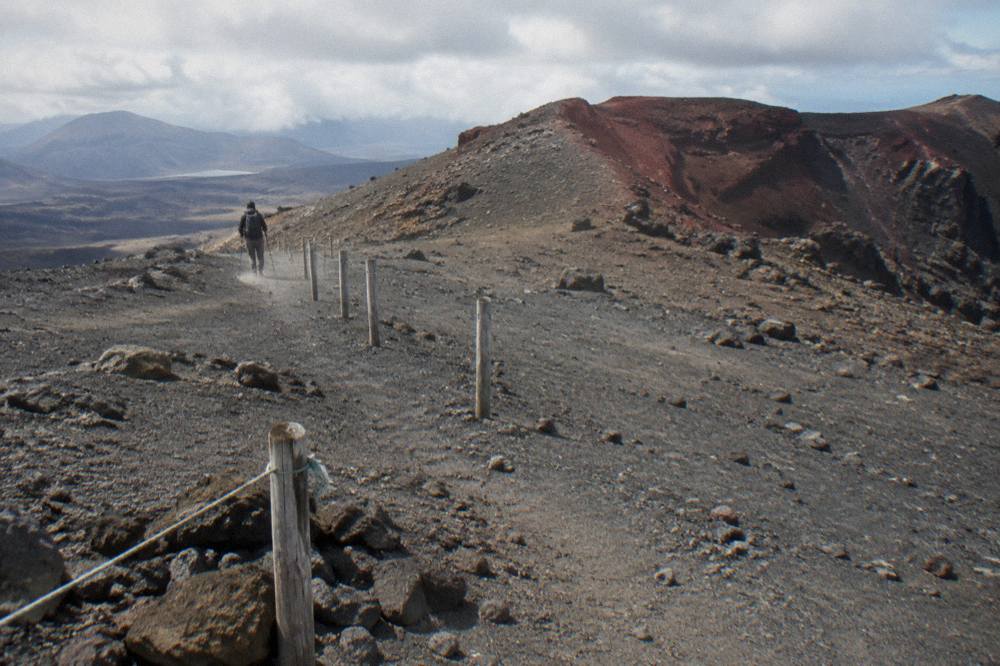
The map shows three climbs and two big descents across 20.2 km: up the Devil's Staircase to South Crater, up again to Red Crater at 1886 m, the highest point, then down scree to the Emerald Lakes, past Blue Lake and down a long zig-zag to Ketetahi Road at 760 m. DOC grades it High fitness, steep and undulating.
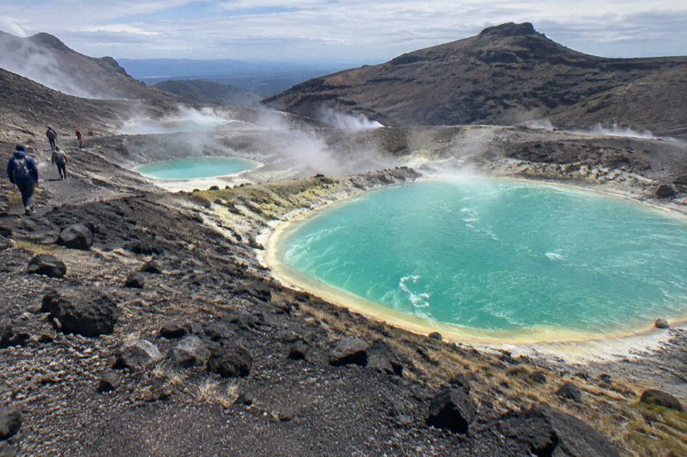
The middle third is what people come for. Red Crater's loose rock is named by DOC as a major slip hazard, so the map's highest point is also its most careful footing. The Emerald Lakes sit just below it in a basin, steaming fumaroles nearby that DOC asks you not to approach, and Blue Lake, Te Wai Whakaata o Te Rangihīroa, sits a little further on. Mount Ngauruhoe stands beside the track as scenery for most of the day, the mountain many visitors know by its popular nickname, Mount Doom, from the Mordor look of the landscape.
Toilets sit every one to two hours along the track, and DOC has a specific tip: if there is a queue at Mangatepopo, the next toilets are 1 km, about 20 minutes, on. That kind of spacing matters when you are planning water. DOC's gear guidance says carry 2 to 3 litres per person because track water is not drinkable.
Walking time on the map depends on the season. DOC says 7 to 8 hours from November to April and 9 hours from May to October, when the track becomes an Expert route and winter daylight runs only 9 to 11 hours. Manaaki Rangers greet visitors daily from November to April at the track and share traditional stories, a small summer-only presence worth knowing about if you like the idea of the mountains being introduced by the people who hold them sacred. If you want to dig deeper into timing and fitness, the guides on how long the Crossing takes and Crossing difficulty and terrain break those numbers down section by section.
Where Do Round-Trip Crossing Shuttles Pick You Up?
Round-trip shuttles pick up in National Park Village, Ohakune, Turangi and Taupo, drop you at Mangatepopo, then collect you at Ketetahi Road in the afternoon for the ride back to your starting town.
The round-trip pattern suits walkers sleeping near the mountains and arriving without a car, or those who simply do not want to think about parking at all. In National Park Village, the Tongariro Crossing Shuttles round trip starts from the Park n Ride at 59 Findlay Street, rated 4.7 across 886 reviews, from $42 per person, making it the most reviewed tour here. Dempsey Buses runs a round trip from pickup points in National Park Village, rated 4.8 across 72 reviews, from $51 per person, with children under 6 not able to travel.
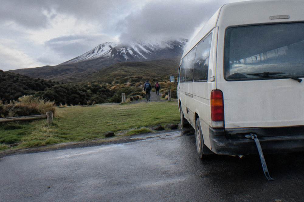
Further afield, the map spreads out. Dempsey Buses runs a return shuttle from Ohakune, rated 4.8 across 19 reviews, from $62 per person. Backyard Tours runs a round-trip transfer from its base on Te Rangitautahanga Road in Turangi, rated 4.9 across 76 reviews, from $51.60 per person, private to your group. From Taupo, the Tongariro Expeditions return shuttle costs from $80.27 per person, rated 4.5 across 25 reviews, with a group maximum of 24. Tongariro Expeditions also sells a mixed shuttle from Taupo, Turangi and the Ketetahi end, from $42 per person, rated 4.7 across 429 reviews, running a peak season from late October to the end of April with off-peak parking in early October and May.
| Round-trip shuttle | Start point | From (USD) | Rating and reviews |
|---|---|---|---|
| Tongariro Crossing Shuttles round trip | Park n Ride, 59 Findlay Street, National Park Village | $42 | 4.7, 886 reviews |
| Dempsey Buses round trip | pickup points in National Park Village | $51 | 4.8, 72 reviews |
| Backyard Tours Turangi transfer | Te Rangitautahanga Road, Turangi | $51.60 | 4.9, 76 reviews |
| Dempsey Buses Ohakune return | Ohakune | $62 | 4.8, 19 reviews |
| Tongariro Expeditions Taupo return | Taupo | $80.27 | 4.5, 25 reviews |
Choosing between them is mostly geography plus price. From Taupo, the round-trip fare is nearly double the National Park Village services because the vehicle covers far more of the map before the track even starts; the saving comes from not needing accommodation near the mountain the night before. From Ohakune and Turangi the fares sit between those poles, and the group size and cancellation terms are the real differentiators. Every round-trip service listed above states free cancellation, most of them up to 24 hours before, so the booking page is the place to confirm the exact terms for your date.
One warning worth carrying from the map to the calendar: DOC says shuttle buses generally do not operate in winter, May to late October, while guided trips include transport. If you are walking outside the summer season, the pickup picture changes completely, and the guide to a winter guided tour of the Crossing covers what replaces the summer shuttles. Shuttles and guides also run only when conditions allow; operators have agreed, as part of their concessions, not to run when a hazardous weather warning is issued.
How Does The Ketetahi Park-And-Ride Work On The Map?
Park-and-ride services flip the map: you drive to a car park at the Ketetahi end, the shuttle takes you to Mangatepopo, and you walk the Crossing back to your own car. It is one-way transport, there is no return ride, and six separate services run this pattern, from $34 per person.
This is the cheapest way onto the track and the one many independent walkers settle on. Because your car waits at the finish, you never wait for an afternoon collection and you can leave the moment your knees reach the road end. The trade is the drive to the Ketetahi side before your walk, and an early start is the norm.
The cheapest per-person option here is the Active Outdoor Adventures one-way shuttle with a secure Ketetahi car park, from $34, rated 4.1 across 81 reviews. Ruapehu Scenic Shuttles and Owhango Adventures both run one-way park-and-rides from the Ketetahi Road end at Otukou, each from $38, rated 4.8 across 665 and 312 reviews respectively. National Park Shuttles starts from a private Ketetahi car park, from $34.40, rated 4.7 across 73 reviews, with a minimum age of 8 and a group maximum of 37.
| One-way park-and-ride | Where you park | From (USD) | Rating and reviews |
|---|---|---|---|
| Active Outdoor Adventures | Secure car park at the Ketetahi end | $34 | 4.1, 81 reviews |
| National Park Shuttles | Private car park at the Ketetahi end | $34.40 | 4.7, 73 reviews |
| Ruapehu Scenic Shuttles | Ketetahi Road end, Otukou | $38 | 4.8, 665 reviews |
| Owhango Adventures | Ketetahi Road end, Otukou | $38 | 4.8, 312 reviews |
| Tongariro Crossing Car Park | Secure parking at the Ketetahi end | $40.13 | 1 review |
| Backyard Tours one-way | Secure parking at the Ketetahi end | $44.72 | 4.8, 53 reviews |
The differences between these six are smaller than they look, but they are real. All six use car parks near the Ketetahi end; check each booking page for whether the car park is secure or private. Review pools vary hugely, from 665 reviews down to a single review on the Tongariro Crossing Car Park service, too few for any star claim, so weigh the long histories more heavily than a lone rating. The Tongariro Crossing Car Park and Backyard Tours one-way services are both private to your group, which matters if you are a family or a party of friends who would rather not share the ride.
If the park-and-ride pattern suits your trip, the shuttle where you park at Ketetahi is the natural place to compare dates and prices, and check availability for your walking day.
Which Shuttle Pickup Point Is Closest To Your Town?
By DOC's distances from the track, Whakapapa sits 10.4 km away, National Park 13.5 km, Turangi 36.7 km, Ohakune 48 km and Taupo 86.5 km. The nearest bed to the start is in the Whakapapa and National Park Village area, and the pickup map follows those distances rather than drive times.
DOC publishes these distances on its own Tongariro Alpine Crossing page, and they are the honest way to compare towns, since it publishes distances, not drive times. National Park Village has two round-trip shuttle services, plus the Adrift Tongariro guided base at 53 Carroll Street, where its guided walks meet. Turangi and Taupo each feed round-trip services, and Ohakune connects through Dempsey Buses.
Auckland is a different story, and the map should not pretend otherwise. It is a long way, and the two products that bridge it are built around an overnight: the Kiwi Road Tours private transfer from Auckland, from $338 with the Crossing shuttle excluded and the walk self-guided, and the ExperienceKart private three-day tour from Auckland, from $3,150.50, where the Crossing is one self-guided leg among Waitomo, Huka Falls and Lake Taupo stops. The guide to reaching the Crossing from Auckland covers both in detail.
Where Can You Park At Each End Of The Crossing?
DOC's rules are strict at both ends: from Labour weekend in late October to 30 April a 4-hour maximum applies at the Mangatepopo and Ketetahi road ends, and in summer there is no parking for Crossing walkers at Mangatepopo car park at all. Near the finish there is a private car park at Ketetahi, and DOC suggests booking a shuttle.
That 4-hour maximum is the structural reason park-and-ride exists. You cannot leave a car at the start for a 7 to 8 hour walk, so the choice collapses to two: a round-trip shuttle from your town, or a one-way shuttle from a Ketetahi-area car park where your vehicle waits at the finish. DOC also advises against parking on State Highway sides, and a fuller treatment of the trade-offs sits in the guide to the car park versus shuttle decision.
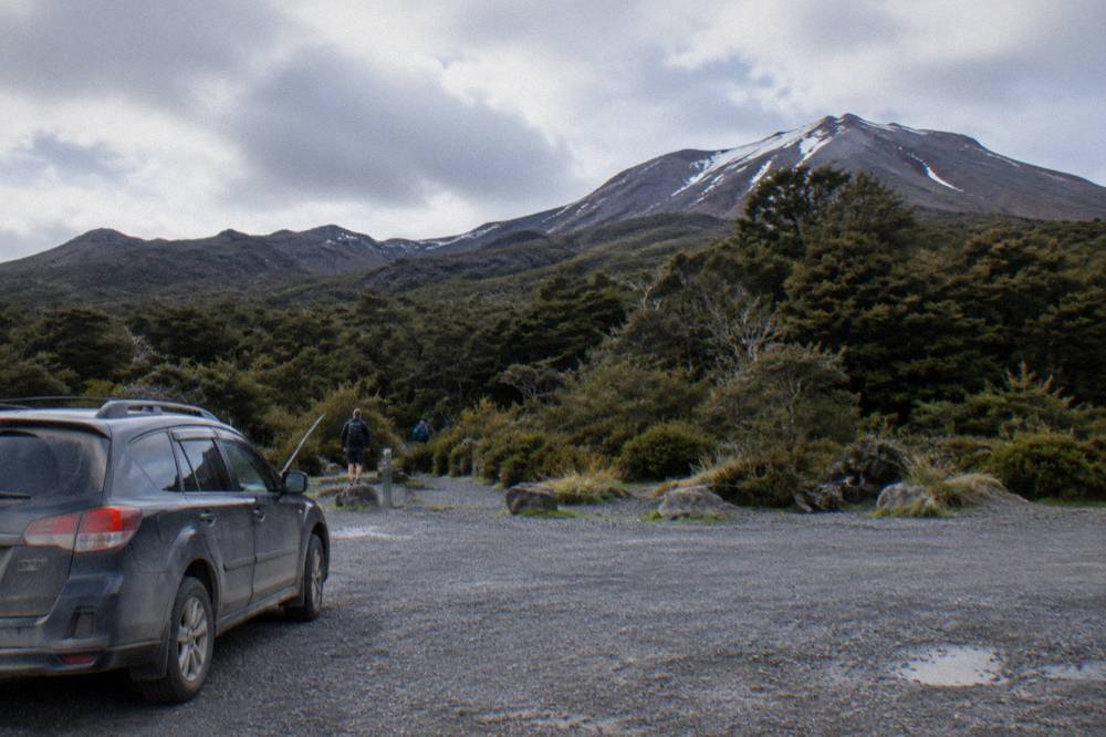
A separate DOC system overlays the parking map: the free track booking introduced in October 2023. It is recommended for everyone using any part of the track, and a booking is needed to use a shuttle or guided walk service, though arriving without one carries no penalty. You show the receipt, digital or paper, to rangers at the car park, and your guide or shuttle operator may make the booking for you. One booking covers one group, and holders of Tongariro Northern Circuit hut or campsite bookings are exempt, though the Northern Circuit is a different track from the Crossing. The guide to booking the Tongariro Crossing walks through it step by step.
Which Direction Does The Crossing Go, And Can You Walk It The Other Way?
The Crossing is walked Mangatepopo to Ketetahi Road, and DOC's own page presents it in that direction; the shuttle system, the advisory signage at the Mangatepopo Road end and the afternoon collections at Ketetahi are all built around it. Walking the reverse means climbing the long northern zig-zag and arranging transport against the grain of every service on the map.
The forward direction gives you the famous reveal in the right order: the valley boardwalk, the staircase, South Crater, Red Crater, then the Emerald Lakes appearing below the rim. In reverse you would meet the steep scree as a climb and finish on the gentler valley gradient, but you would also be walking against the flow of hundreds of walkers and, more practically, against the entire pickup network. For almost everyone reading a map and choosing a shuttle, forward is the only sensible answer.
Weather does not care which direction you walk, and the advisory system sits at the Mangatepopo end. DOC's summer "Not Recommended Today" advisory is assessed each morning and applies when the NIWA Red Crater forecast crosses thresholds such as average wind of 55 kph or more, gusts of 70 kph or more, wind chill of minus 10 °C or colder, or 10 mm of precipitation over six hours. When it is applied, signage goes up at the Mangatepopo Road end and operators and isites are emailed. From May to October no hazardous weather advisories are issued at all, so in winter you read the forecast yourself. You can check conditions through the DOC Tongariro Alpine Crossing page and alerts.
When Should You Choose A Guided Tour Instead Of A Shuttle?
Adrift Tongariro runs the three guided tours listed here, all meeting at its base at 53 Carroll Street, National Park Village, with return transport included: the premium guided Crossing hike from $253 per person, rated 4.6 across 241 reviews, a half-day guided walk from $197 that is not the full Crossing, and a private guided Crossing from $774.01. None of the shuttles includes a guide.
On the map, the difference is simple. A shuttle touches two points, Mangatepopo and Ketetahi Road, and the space between is yours alone. A guided tour moves those two points to one, the Adrift base, and puts someone who reads the weather, the footing and the volcanic landscape beside you for the whole 20.2 km. On the premium hike the group runs up to 60, the minimum age is 12, and crampons and ice axes are supplied for winter conditions if required, alongside a clothing and footwear allowance; lunch is not, so bring your own.
| Adrift Tongariro guided tour | Format | From (USD) | Rating and reviews | Cancellation |
|---|---|---|---|---|
| Premium guided Crossing hike | Full Crossing, guided, up to 60 walkers | $253 per person | 4.6, 241 reviews | Free up to 14 days before |
| Half-day guided walk | Shorter guided walk, not the full Crossing | $197 per person | 4.7, 27 reviews | Free up to 14 days before |
| Private guided Crossing | Full Crossing, private to your group | $774.01 | 4.5, 30 reviews | Non-refundable |
The guided option earns its price most clearly in the winter months, May to late October, when DOC grades the route Expert, expects ice on the track, and lists the full winter kit, crampons, ice axe, helmet and avalanche equipment, as essential for independent trips. DOC's own winter advice is blunt: go with a guide. Even in summer, Red Crater runs at least 10 °C colder than Taupo on a calm day, and you subtract another 2 °C for every 10 km/h of wind. A guide also carries the judgement that the map cannot, knowing when the scree on Red Crater is safe to descend and when the group should turn back.
Cancellation terms differ enough to matter before you commit. The premium and half-day guided tours allow free cancellation up to 14 days before, the private guided Crossing is non-refundable, and the park-and-ride and round-trip shuttles mostly allow free cancellation up to 24 hours before; the booking page shows the terms for each one. DOC's winter essentials are on its Tongariro Alpine Crossing page; for avalanche conditions, check the New Zealand avalanche forecast for the Tongariro region.
The map, in the end, is a decision about ends. Park at Ketetahi and ride to the start, and your day ends at your own car. Ride round trip from your town, and someone else owns both ends. Meet a guide in National Park Village, and the ends take care of themselves while you watch the volcanoes.
Common Questions About The Tongariro Crossing Map And Shuttle Pickups
Where Does The Tongariro Crossing Start And Finish?
It starts at Mangatepopo, at 1120 m in the Mangatepopo Valley, and finishes at Ketetahi Road at 760 m on the northern side. The track is 20.2 km one way and DOC's direction of travel is Mangatepopo to Ketetahi Road.
Can I Park At The Start Of The Tongariro Crossing?
No. DOC says there is no parking for Crossing walkers at Mangatepopo car park in summer, and from Labour weekend in late October to 30 April a 4-hour maximum applies at the road ends. DOC suggests booking a shuttle.
Is There A One-Way Shuttle From Ketetahi To Mangatepopo?
Yes, six of them. You park at a car park at the Ketetahi end, ride to Mangatepopo, and walk the Crossing back to your own car. Prices start from $34 per person.
Where Do Round-Trip Shuttles Pick Up?
National Park Village, Ohakune, Turangi and Taupo. They drop you at Mangatepopo and collect you at Ketetahi Road in the afternoon. None of these shuttles includes a guide.
Which Is The Closest Town To The Crossing?
By DOC's distances from the track, Whakapapa is 10.4 km away and National Park Village 13.5 km, followed by Turangi 36.7 km, Ohakune 48 km and Taupo 86.5 km.
Do Shuttles Run In Winter?
DOC says shuttle buses generally do not operate in winter, May to late October, but guided trips include transport. The Adrift Tongariro guided tours run in summer and winter, with crampons and ice axes supplied for winter conditions if required.