Tongariro Alpine Crossing Difficulty: Fitness Needed And When A Guided Hike Helps
DOC rates the fitness requirement for the Tongariro Alpine Crossing as High, over 20.2 km of steep and undulating track with 1196 m of climbing and descent. Here is what that rating means in practice, section by section, and where a guide genuinely helps.
Short answer
DOC rates the Tongariro Alpine Crossing as High fitness, a 20.2 km one-way intermediate tramping track in summer taking 7 to 8 hours, rising from 1120 m at Mangatepopo to 1886 m at Red Crater with plus and minus 1196 m of elevation. In winter, May to October, it becomes an Expert route needing alpine skills. It is not recommended for children under 10.
DOC's own track classification answers the difficulty question for the Tongariro Alpine Crossing: a High fitness requirement, an intermediate tramping track in summer, and an Expert alpine route from May to October. The 20.2 km one-way distance is only part of the story. What makes the Crossing hard is the plus and minus 1196 m of elevation, the loose scree on Red Crater, the long stepped descent, and a summit zone that can be at least 10 °C colder than Taupo on a calm day. This guide breaks the difficulty into pieces you can actually train for and plan around, and looks honestly at what the guided options change and what they cannot. If you're wondering whether that effort still fits into a single day, the guide to completing the Tongariro Alpine Crossing in one day explains how shuttles, start times and pacing decide the outcome.
How Hard Is The Tongariro Alpine Crossing Really?
DOC classifies the Crossing as a High-fitness, steep and undulating intermediate tramping track in summer: 20.2 km one way, 7 to 8 hours of walking from November to April, with 1196 m of climbing and the same again descending, from 1120 m at Mangatepopo over Red Crater at 1886 m down to 760 m at Ketetahi Road. In winter it is an Expert route. Those official numbers frame everything else on this page, and they come from DOC's Tongariro Alpine Crossing page, which is also where seasonal alerts and advisory notices are published.
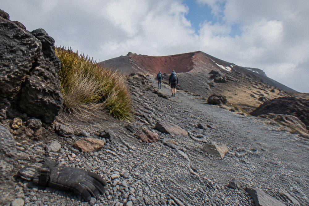
In practice, "intermediate with High fitness" translates to a day of continuous effort rather than any single technical obstacle. The track climbs around 350 m up the Devil's Staircase to the South Crater plateau, pushes up to Red Crater, drops steeply on loose rock to the Emerald Lakes, then descends for hours on steps and zig-zags. DOC notes that loose rock on Red Crater is a major slip hazard and that the many steps on the descent can trouble weaker knees. Slipping accounts for 38 percent of tramping injuries in the park's own safety material, which is why sturdy boots matter more than any other single piece of gear.
Nothing on the summer track requires ropes, scrambling or route-finding experience, provided you stay on the marked line. The difficulty is cumulative: it is a long day out in changeable weather with no shortcuts once you are past Soda Springs. Walkers who complete day hikes of similar length at home, on hills, generally manage.
What Fitness Do You Need For The Tongariro Alpine Crossing?
You need the fitness to walk 20.2 km over steep and undulating ground for 7 to 8 hours carrying a day pack, in weather that can change from sun to sleet within an hour. As a training benchmark, being comfortable doing a hilly 6 to 7 hour day hike, twice in a week, puts you in the right zone for a summer Crossing. DOC's rating is High, and there is no way to soften that into a casual stroll.
Three specific demands are worth training for. First, sustained climbing: the Devil's Staircase section gains around 350 m on steps and rock, and it comes early enough in the day that most people arrive with fresh legs but leave tired. Second, descending: the northern slopes after Blue Lake fall from the high point of Red Crater at 1886 m all the way to the 760 m road end on a long zig-zag and stepped track, and quad fatigue, not the climb, is what breaks most people's day. Third, time on feet: seven to eight hours is longer than most gym routines ever simulate, so practice walks of five hours or more are worth more than any short intense session.
There is a built-in fallback worth knowing. The first 5.4 km of the Crossing is shared with the easy Soda Springs Walk, a 2 hour return option DOC describes for people who do not have the fitness for the harder parts. Turning around at Soda Springs is a real, respectable plan for families or walkers testing their legs, and it still delivers valley views of Ngauruhoe. If the full distance looks marginal, that section is your safety valve.
Which Sections Of The Tongariro Crossing Are The Hardest?
Three sections carry most of the difficulty: the Devil's Staircase climb of around 350 m to South Crater, the ascent and loose-scree descent of Red Crater at 1886 m, and the long stepped descent of the northern slopes toward Ketetahi Road at 760 m. Each one punishes a different weakness, and knowing which is which helps you pace the day.
| Section | What it involves | Why it is hard |
|---|---|---|
| Mangatepopo Valley to Soda Springs | 5.4 km of boardwalk and gentle track, shared with the 2 hr return Soda Springs Walk | Easy, but it eats time and energy before the real climbing starts |
| Devil's Staircase | Around 350 m of steady climbing on steps and rock to the South Crater plateau | Relentless gradient; the point where undertrained legs first fail |
| South Crater to Red Crater | Ascent to 1886 m, the highest point of the track | Altitude exposure, wind, and cold even in summer |
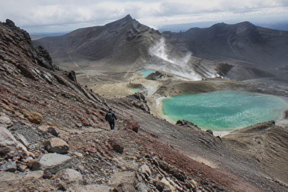
| Red Crater to Emerald Lakes | Steep scree descent | Loose rock is a major slip hazard per DOC |
| Northern slopes to Ketetahi Road | Long zig-zag and stepped descent from 1886 m down to the 760 m road end | Many steps trouble weaker knees; quad fatigue and the longest section of the day |
The scree below Red Crater deserves particular respect. DOC flags the loose rock as a major slip hazard, and this is where the 38 percent slipping-injury statistic becomes real: every step slides a little, tired walkers shorten their stride, and short strides on scree are less stable, not more. Plant your heel deliberately, use poles if your knees allow, and do not let the Emerald Lakes photograph rush you. Fumaroles near the lakes are part of the same active volcanic zone, and DOC asks visitors not to approach the steam vents or touch and enter any of the waterways, a request from Ngati Hikairo ki Tongariro to respect the sacred mountains.
The descent is the section people underestimate. After the drama of the crater and lakes, the track drops through long zig-zags with views over Lake Rotoaira and Lake Taupo, then into forest. It is genuinely beautiful and genuinely long. Walkers who sprinted the morning sections pay for it here, and the last kilometres to the road end at 760 m can feel like the longest of the day. For more detail on the day's structure, the route highlights along the Crossing guide walks through the same sections with timings in mind.
How Long Does The Crossing Take If You Are Not Super Fit?
DOC's official walking time is 7 to 8 hours from November to April and 9 hours from May to October. Slower, less confident walkers on a summer day should expect the top of DOC's 7 to 8 hour range or beyond, plus rest stops, so plan for a full day on the track. The posted range is a mid-point, not a ceiling.
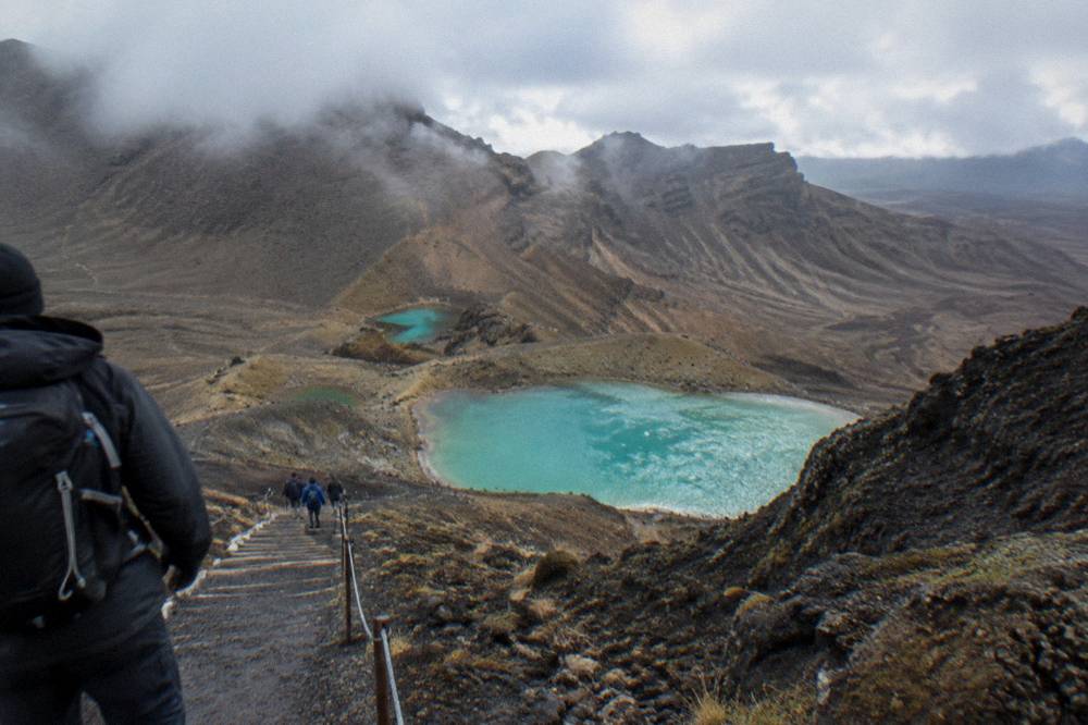
Time pressure on the Crossing is structural, not social. Shuttles run to a day's schedule, the 4 hour summer parking maximum at the road ends removes the option of a leisurely self-drive start, and daylight in winter runs only 9 to 11 hours, which is exactly why DOC says to allow 9 hours and always carry a head torch. A walker averaging the slow end of the range needs the full buffer. Building in an extra hour means you can wait out a squall at South Crater instead of pushing through it, and waiting out weather is often the correct alpine decision. The full index of guides sits on Tongariro Alpine Crossing Tours.
Rest stops matter more than walking speed. Toilets sit every 1 to 2 hours along the track, and DOC notes that if there is a queue at Mangatepopo the next toilets are 1 km, about 20 minutes, further on. Plan food and layer changes around those stops rather than improvising. The question of pacing connects to start times, and the best time to start the Crossing post covers the morning logic in detail; the short version is an early start buys you the whole buffer.
The Adrift Tongariro premium guided Crossing hike is booked as an 8 to 9 hour day including return transport, rated 4.6 across 241 reviews, from $253 per person.
That 8 to 9 hour window already accounts for a group moving at a sociable pace with stops, which is why it runs longer than DOC's bare 7 to 8 hour walking figure. If a guided day sounds like the right fit, the options below link straight to each operator's live booking page.
Is The Tongariro Crossing Harder In Winter?
Yes, categorically. From May to late October DOC reclassifies the Crossing from an intermediate tramping track to an Expert route: snow, ice, avalanche risk and sub-zero temperatures, a 9 hour walking allowance, crampons, ice axe and helmet described as essential, and the competency to use them. Winter is a different sport played on the same track.
The temperature math alone changes the day. On a calm day DOC says Red Crater is at least 10 °C colder than Taupo and 5 °C colder than the track start, and you subtract another 2 °C for every 10 km/h of wind. A mild Taupo morning of 10 °C can mean roughly 2 °C at Red Crater before wind chill. DOC expects ice on the track between April and October, and no hazardous weather advisories are issued from May to October, so reading the forecast yourself, or going with an operator who does, is part of the route's own rules. The avalanche forecast lives at avalanche.net.nz.
| Factor | Summer, Nov to Apr | Winter, May to Oct |
|---|---|---|
| Track category | Intermediate tramping track | Expert route |
| Walking time | 7 to 8 hours | 9 hours |
| Key hazards | Sun, wind, changeable weather, scree | Snow, ice, avalanche, sub-zero cold |
| Gear beyond summer kit | Boots, layers, water | Crampons, ice axe, helmet, avalanche gear, head torch |
| Weather advisory system | Assessed each morning in season | No advisories issued, read the forecast yourself |
| Shuttles | Generally operating | Generally not operating, guided trips include transport |
Those seasonal differences are exactly why many walkers read the guide to staying safe on the Tongariro Crossing before committing to a date.
Shuttle logistics shift in winter too. DOC states that shuttle buses generally do not operate during winter, but guided trips include transport. For the full winter picture, see the winter guided tour guide, which works through gear, season boundaries and what the guided day includes.
Does A Guided Hike Make The Crossing Easier?
A guide does not remove the 20.2 km, the 1196 m of climbing or the scree, and no honest operator claims otherwise. What the guided tours add is decision-making, alpine gear in winter, transport, and a pace set for the group, which converts an unknown day into a managed one. The difficulty stays; the uncertainty shrinks.
Adrift Tongariro runs the three guided tours on this site, and their inclusions are specific. The premium guided hike, from $253 per person and rated 4.6 across 241 reviews, includes return transport from the Adrift base at 53 Carroll Street in National Park Village, crampons and ice axes supplied for winter conditions if required, plus a clothing and footwear allowance, and runs with a group of up to 60 and a minimum age of 12. Lunch is not included, so bring your own. It can be cancelled free up to 14 days in advance for a full refund. The private guided Crossing, from $774.01, keeps the same inclusions as the group walks, but it is non-refundable, which matters if your plans are soft.
| Tour | Price from | Duration booked | Rating | What it changes about difficulty |
|---|---|---|---|---|
| Adrift premium guided hike | $253 per person | 8 to 9 hours | 4.6 across 241 reviews | Guide, return transport, winter gear, group pace |
| Adrift half-day guided walk | $197 per person | 4 hours | 4.7 across 27 reviews | A shorter guided walk, not the full Crossing |
| Tongariro Crossing Shuttles round trip | $42 per person | 8 hours | 4.7 across 886 reviews | Transport only, self-guided walk |
For walkers whose real worry is whether they can finish at all, the Adrift Tongariro half-day guided walk is the honest middle path: from $197 per person, rated 4.7 across 27 reviews, a 4 hour guided walk that is explicitly not the full Crossing, with return transport and the same winter gear support.
The comparison worth making is not guided versus easy but guided versus unsupported. A confident, fit, well-equipped walker with a shuttle seat has an excellent day and pays from $42 for the round trip. A walker who is fit enough but new to alpine terrain, or travelling in the shoulder season when ice appears, gets more from the guide than the price difference suggests. If that trade-off is still unclear, whether you can hike Tongariro without a guide works through the decision in full, and the guided tour guide compares the options side by side.
Should You Take A Shuttle Or A Guided Tour For A First Crossing?
If your only question is difficulty, book the guided hike. The shuttle is the right choice for walkers who are confident in their fitness, navigation and gear; the guide earns its price for everyone else, especially from April, when ice can appear, and from May to late October, when shuttles generally stop running. Both are legitimate, and the decision maps cleanly onto how you honestly answer three questions.
The Tongariro Crossing Shuttles round-trip from National Park Village, from $42 per person and rated 4.7 across 886 reviews, spans an 8 hour day window: morning pickup from the Park n Ride at 59 Findlay Street in National Park Village, afternoon return from Ketetahi, free cancellation up to 24 hours ahead. It is transport, not guidance, and it suits walkers who want to set their own pace.
Ask yourself: could I happily walk a hilly 20.2 km tomorrow? Do I own or will I hire proper boots and layers? Would I recognise when to turn back? Three yeses and the shuttle is a sound, cheap choice. Any hesitation, particularly about turning back, is exactly what a guide is for. A reader weighing difficulty should also glance at what to bring on the hike, because gear failures cause more difficult days than fitness failures do, and at the wider difficulty and safety picture if weather anxiety is part of the worry.
There is one more structural point in the guide's favour for nervous first-timers. Guided operators have agreed, as part of their concessions, not to run when a Hazardous Weather Warning is issued; the 'Not Recommended Today' advisory is not a closure and not a ban. Deciding not to walk is the hardest call of the day for most people, and on a guided trip that decision is made for you by people who make it every day.
How Do You Train For The Tongariro Alpine Crossing?
Train for hills and hours, not distance: build to a hilly 6 to 7 hour day hike with a loaded pack in the month before your walk, add stair or hill-descents for the quads, and break in your boots over at least several long walks beforehand. The Crossing rewards time on feet more than gym strength.
Start eight weeks out if you walk regularly, twelve if you do not. One long walk per week, growing by an hour each fortnight until you reach six or seven hours, does most of the work. Add one shorter hill session weekly, and make at least some of every long walk a descent rather than a loop that avoids it: the stepped descent from Red Crater at 1886 m to the 760 m road end is a specific muscular demand, and it is trainable. Wear the boots you will wear on the day, every session, so the blister risk transfers to training rather than to Red Crater.
On the day itself, three habits carry undertrained walkers further than any training program: eat before you are hungry, drink before you are thirsty, and add a layer at the first sign of cooling rather than after the shivering starts. Carry 2 to 3 litres of water, because DOC is explicit that track water is not drinkable. If the whole program still looks like too much, the Soda Springs fallback from earlier in this guide remains open: 5.4 km in, the same distance back, and Ngauruhoe, whose Mount Doom nickname makes it the most photographed backdrop on the track, standing over the valley the whole way.
Is The Tongariro Alpine Crossing Suitable For Children?
DOC advises the track is not recommended for children under 10, and the guided tours set their own bars: the Adrift premium and private guided hikes require a minimum age of 12. There is no single site-wide age rule, so check the specific tour. For younger walkers the Soda Springs Walk, an easy 2 hour return, is the family-friendly version of the day.
The under-10 advisory is DOC's, and it reflects the day's length and exposure rather than any technical hazard: a child who slows at kilometre 14 is a long way from either road end, in weather that can turn. Families with keen 10 to 11 year olds can self-guide with a shuttle seat, checking the booking page for any age minimum, and should plan the Soda Springs turnaround as a live option rather than a defeat. Whatever the age, the cultural request from Ngati Hikairo ki Tongariro applies to everyone on the track: respect the sacred mountains by not touching or entering any of the waterways, including the alpine lakes.
If difficulty is the worry that brought you here, this guide breaks the day down, from a fully guided crossing to a self-guided walk with transport.
Common Questions About The Tongariro Alpine Crossing Difficulty
How Hard Is The Tongariro Alpine Crossing?
DOC rates it High fitness: 20.2 km one way, steep and undulating, 7 to 8 hours in summer and an Expert route in winter with 9 hours allowed. Most reasonably fit adults who train with long hill walks complete it; it is not a casual stroll.
How Fit Do I Need To Be For The Tongariro Alpine Crossing?
You need the stamina for a hilly 7 to 8 hour day walk with a pack. A good benchmark is comfortably finishing a 6 to 7 hour hill hike in the weeks before your trip, with strong legs for the long descent.
What Is The Hardest Part Of The Tongariro Crossing?
The Devil's Staircase climb, the loose scree descent from Red Crater at 1886 m, and the long stepped descent toward Ketetahi Road at 760 m. The descent is what breaks most people's day, not the climb.
Can Beginners Do The Tongariro Alpine Crossing?
Fit beginners do it in summer, often with a guide for pace and decision-making. True beginners, or anyone unsure of the full 20.2 km over hills, should train first or use the Soda Springs Walk, which shares the first 5.4 km of track, as the day's goal.
Does A Guided Hike Make The Crossing Easier?
It removes uncertainty rather than distance: a guide sets pace, supplies winter gear, arranges transport and makes the weather call. The 20.2 km and 1196 m of climbing remain either way.
Is The Tongariro Crossing Harder In Winter?
Yes. From May to October DOC classes it an Expert route with snow, ice and avalanche risk, requiring crampons, ice axe, helmet and the skills to use them, with 9 to 11 hours of daylight.