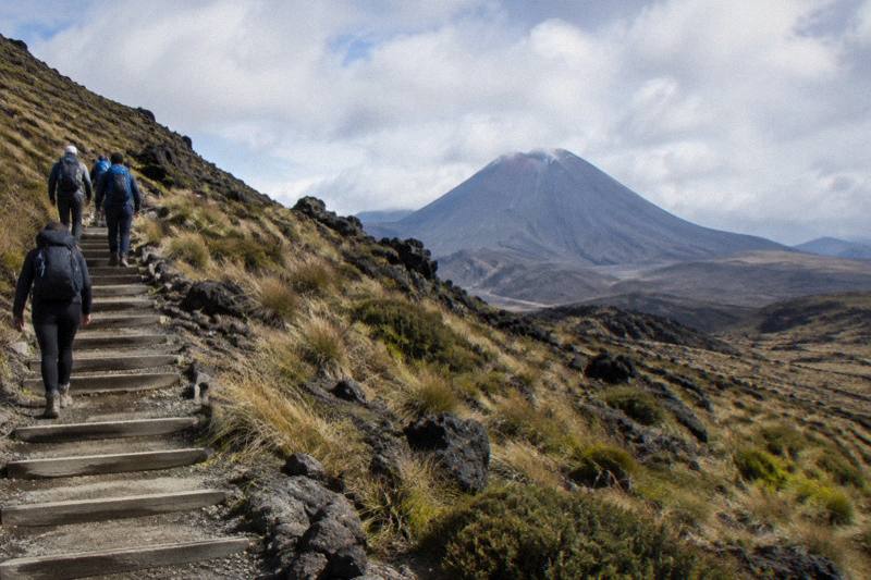
Devil's Staircase, Emerald Lakes And Red Crater On A Tongariro Guided Hike
The three names everyone repeats about the Tongariro Alpine Crossing, the Devil's Staircase, the Emerald Lakes and Red Crater, are also the three sections that decide whether you want a guide beside you.
Short answer
The Devil's Staircase is a climb of around 350 m up a staircase to the South Crater plateau, Red Crater is the 1886 m high point with loose scree, and the Emerald Lakes sit just below it on a steep descent. On this site, the Adrift Tongariro premium hike covers all three, from $253 per person for the full Crossing.
Red Crater sits at 1886 m, the highest point of the Tongariro Alpine Crossing, and the Department of Conservation calls the loose rock on its rim a major slip hazard. Below it, the Emerald Lakes glow mineral green in a basin of scree. Below them again, a long zig-zag descent drops toward forest and the Ketetahi Road end at 760 m. These three features, together with the staircase climb that delivers you to them, are why people book this walk at all, and they are also where the track is most demanding and most exposed to weather. Loose rock and scree like this are hard on footwear, so the guide to wearing sneakers on the Tongariro Alpine Crossing is worth a read before you pack.
This page walks through each landmark as the Department of Conservation describes it, then looks at what changes when a guide walks with you. Adrift Tongariro runs the three guided tours on this site, and the differences between them matter if the Emerald Lakes are the reason you are going.
What Are The Devil's Staircase, Emerald Lakes And Red Crater?
The Devil's Staircase is the popular name for the staircase climb of around 350 m that carries walkers from the Mangatepopo Valley up to the South Crater plateau, Red Crater is the 1886 m summit ridge beyond it, and the Emerald Lakes, Nga Rotopounamu, sit in a basin immediately below Red Crater on a steep scree descent. Together they form the alpine heart of the 20.2 km one-way track. For anyone wondering how these sections stack up in difficulty, this ranking of the hardest parts of the Tongariro Crossing explains which stretch demands the most.
The Department of Conservation describes the route sequence plainly. You leave the Mangatepopo Valley on boardwalk, climb the staircase to the South Crater plateau, ascend to Red Crater, descend steeply on scree to the Emerald Lakes, pass Blue Lake, also called Te Wai Whakaata o Te Rangihiroa, then take the long zig-zag descent of the northern slopes with views over Lake Rotoaira and Lake Taupo before forest delivers you to Ketetahi Road. Nothing on the track is more photographed than the lakes, and nothing is more talked about beforehand than the staircase.
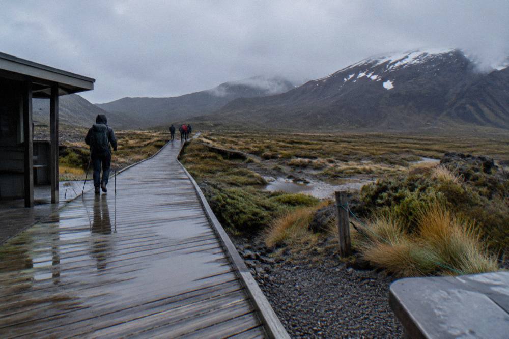
The track is classed as an Intermediate tramping track in the November to April season, with high fitness required and a steep, undulating gradient. DOC puts summer walking time at 7 to 8 hours for the full 20.2 km. In winter, May to October, the same track becomes an Expert route over snow and ice, and DOC says to allow 9 hours. The landmarks do not move between seasons, but the ground under them changes completely.
Context matters too. The Crossing passes through Tongariro National Park, New Zealand's oldest national park, established in 1894, and a dual World Heritage area. In 1993 it became the first property inscribed under the revised cultural landscape criteria. The mountains are sacred to Ngati Hikairo ki Tongariro of Ngati Tuwharetoa, the kaitiaki of the maunga, and that sacredness has practical effects on the track, most visibly in the request not to touch or enter any of the waterways, including the alpine lakes. More background on the whole route sits in the full Tongariro Crossing track guide.
How Hard Is The Devil's Staircase Climb On The Tongariro Crossing?
The Devil's Staircase climbs around 350 m from the Mangatepopo Valley floor to the South Crater plateau on a stepped track, and DOC rates the overall track as requiring high fitness. Most walkers manage it with steady pacing and regular breaks, but it is the first point where the day stops being an easy valley stroll and starts being an alpine tramp.
The staircase is a human-made blessing as much as a curse. The climb feels long rather than technical, and the valley view behind you grows with every pause. DOC notes the track starts at 1120 m at Mangatepopo, so you are already well above sea level before the staircase even begins.
A useful fallback exists at the base. The first 5.4 km of the Crossing is shared with the Soda Springs Walk, an easy two-hour return option for people who do not have the fitness for the harder parts beyond. If the staircase defeats you, or the weather turns, you can still see the valley and turn back without committing to Red Crater. A guide makes that decision with you rather than leaving you to guess.
The staircase is also where the crowd compresses. Hundreds of walkers converge onto the same steps on a fine summer day, and the polite convention is to let faster walkers pass on the wider sections. Manaaki Rangers greet visitors daily from November to April at the track and share traditional stories, which is worth stopping for, since their presence is unique to the summer season on this walk.
Here is how the landmarks line up in elevation, using DOC's figures:
| Section | Elevation | Character |
|---|---|---|
| Mangatepopo start | 1120 m | Boardwalk through the valley |
| Devil's Staircase | climbs around 350 m | Stepped ascent to South Crater plateau |
| Red Crater high point | 1886 m | Loose scoria rim, exposed |
| Emerald Lakes basin | below Red Crater | Steep scree descent to the lakes |
| Ketetahi Road finish | 760 m | Zig-zag descent, views, then forest |
What Is Red Crater Like At 1886 Metres?
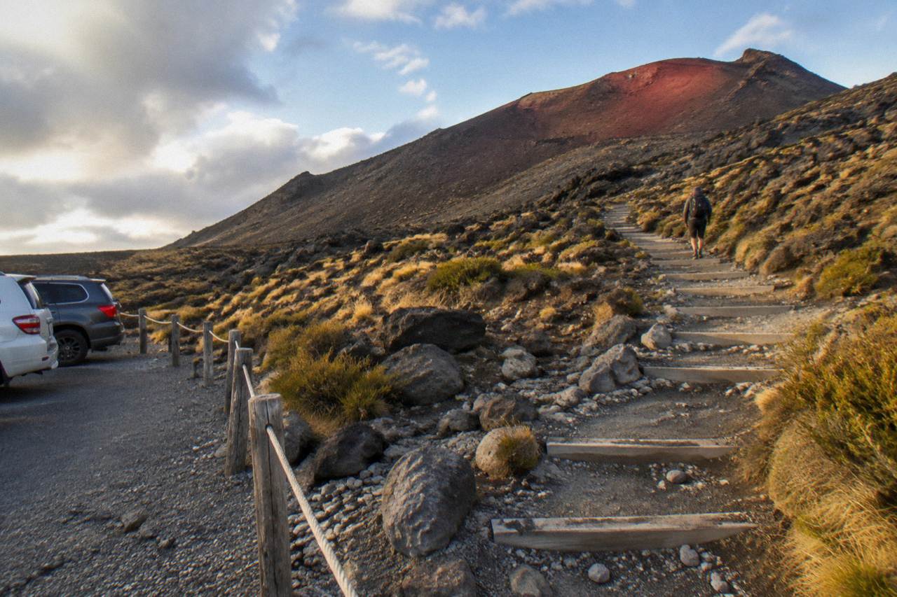
Red Crater is the highest point of the Crossing at 1886 m, an exposed ridge of loose red and orange scoria where DOC identifies the loose rock as a major slip hazard. On a calm day it is at least 10 °C colder than Taupo and 5 °C colder than the track start, and wind strips another 2 °C of warmth for every 10 km/h.
The colour is real, not a photograph's flattery. Iron staining paints the crater walls in rust and ochre against grey ash, and steam can rise from vents near the track. The Crossing traverses an active volcanic area, and DOC states plainly that although unlikely, eruptions can occur at any time. The most recent eruption from Te Maari was in 2012. The hazard zone is a 3 km radius around each of the three Tongariro vents, and if volcanic alert levels rise at Tongariro or Ngauruhoe there will be track or section closures; if unrest centres on Red Crater or is uncertain, DOC closes the whole Crossing.
The ground is the everyday danger. The final pull to the crater rim is on shifting scree, and the descent off the far side toward the Emerald Lakes is steeper still, with loose stone that runs underfoot. DOC attributes 38 percent of tramping injuries to slipping. Sturdy boots matter here more than anywhere else on the track, and this stretch is the strongest single argument for walking with someone who has crossed it hundreds of times.
Wind is the other factor that reshapes the day. The crater rim offers no shelter at all, and DOC's temperature rule is worth committing to memory: whatever Taupo is showing, knock at least 10 °C off for Red Crater on a calm day, then subtract 2 °C more for every 10 km/h of wind. A pleasant lakeside morning in Taupo can mean a sub-zero, glove-and-beanie ascent two hours later.
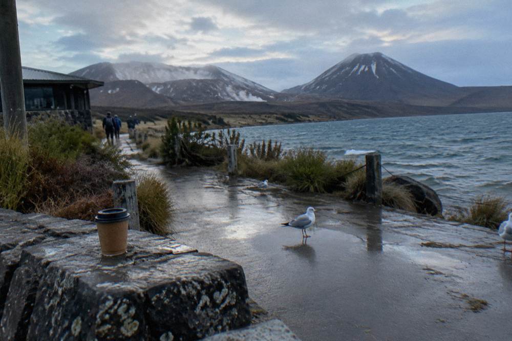
The premium guided Crossing hike from Adrift Tongariro covers this ground with a guide who reads both the track and the sky, from $253 per person for a day of 8 to 9 hours including return transport. If Red Crater in your imagination is the moment of the day, that is the tour built around it.
Why Can't You Swim In The Emerald Lakes?
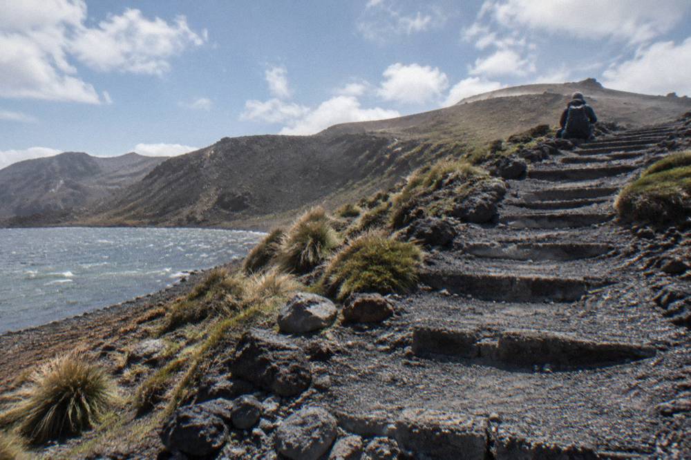
Ngati Hikairo ki Tongariro, the iwi who are kaitiaki of the mountains, ask visitors to respect the sanctity of the sacred mountains by not touching or entering any of the waterways, including the alpine lakes. The lakes are also geothermal, with fumaroles nearby, and DOC advises against approaching steam vents at all.
The request is cultural and it is direct. Kaumatua Te Ngaehe Wanikau's words, carried on DOC's own pages, extend to every waterway on the maunga: Tongariro and his peaks Ngauruhoe and Ruapehu are sacred, and the lakes are part of that. For a walker this means admiring the Emerald Lakes from the track, taking photographs from the shore, and keeping hands and boots out of the water. It is a small act of respect in a place that has been significant for 30 generations, since the ancestor Ngatoroirangi ascended the mountains and named Tongariro.
The geothermal reality reinforces the etiquette. Fumaroles, steam vents, sit near the Emerald Lakes, and DOC tells walkers not to approach them. The lakes' famous colour comes from minerals leaching from the volcanic ground around them, which is also why the water is not for drinking, like all track water on the Crossing. DOC recommends carrying 2 to 3 litres per person for exactly this reason.
The lakes are also a natural half-way pause on the descent off Red Crater. Most guided groups stop here for food and a layer change, because the steep scree above demands attention and the zig-zag below goes on for hours. Bring your own lunch: the Adrift guided tours do not include food, and DOC's route notes place the next toilets up to an hour or two further along the track, so use the facilities on the schedule your guide sets rather than the urge.
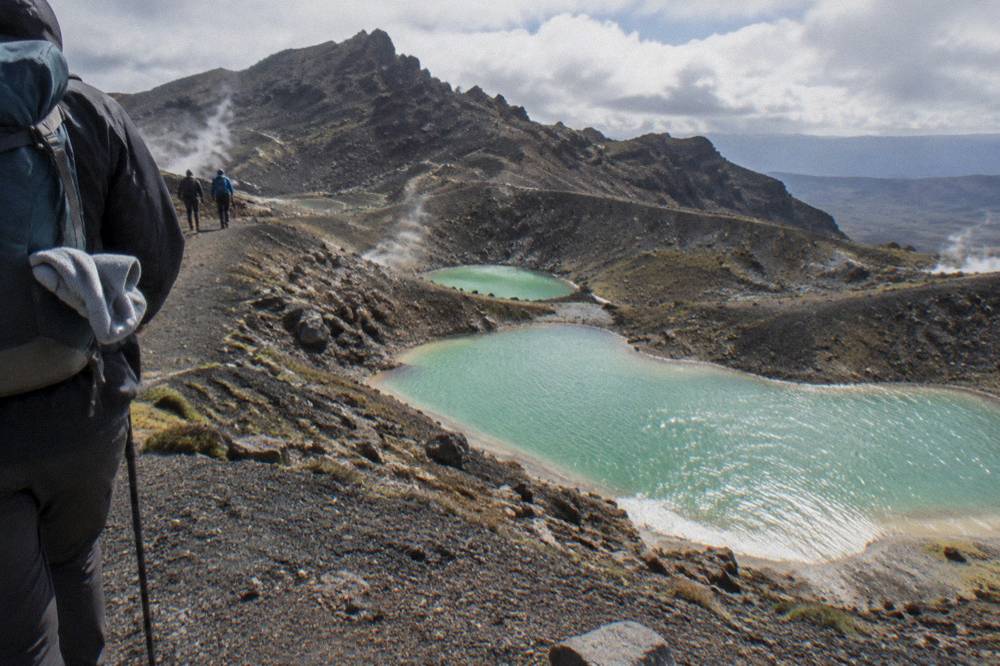
Blue Lake comes shortly after, perched above the northern slopes, and it carries the same request. From there the route tips over onto the long zig-zag descent, and suddenly the day is all about Lake Rotoaira and Lake Taupo laid out below, then forest, then the road end. The emerald moment is brief; the memory of it is why most people came.
Which Guided Tour Actually Walks You Past All Three?
The Adrift Tongariro premium guided hike is the full guided Crossing, 8 to 9 hours, from $253 per person, rated 4.6 across 241 reviews, with return transport included and a minimum age of 12. The half-day guided walk, from $197, is a shorter guided walk that does not cover the full Crossing, and the private guided Crossing, from $774.01, puts a guide with only your group.
Adrift Tongariro runs the three guided tours of this track, and all three meet at the operator's base at 53 Carroll Street, National Park Village. Hotel pickup is not included, and you should bring your own lunch on any of them. Cancellation differs sharply between them, which matters when mountain weather is involved: the premium hike and the half-day walk offer free cancellation up to 14 days in advance, while the private Crossing is non-refundable and cannot be changed for any reason. The booking page shows the cancellation terms in full. Once the booking details are settled, the guide to free walks and ranger talks around the Crossing shows how to fill the rest of your National Park stay without spending a cent.
Winter conditions change what a guide carries rather than whether the tour runs. On all three Adrift tours, crampons and ice axes are supplied for winter conditions if required, alongside a clothing and footwear allowance. DOC's own winter advice is blunt: crampons, ice axe and helmet are essential between May and October, as is competency using them. A guide supplies both the equipment and the competency.
The premium hike runs with a group of up to 60 and a minimum age of 12, an operator rule for that tour. The private Crossing, rated 4.5 across 30 reviews, has the same minimum age of 12 and gives you the guide exclusively, with crampons, ice axes and all clothing and footwear hire supplied. The private walk runs from $774.01, so compare it with the premium hike on what it delivers, not on a fare.
If you want the guide's knowledge without the full 20.2 km commitment, the Adrift half-day guided walk, from $197 per person and rated 4.7 across 27 reviews, is a genuinely shorter guided walk, not a truncated Crossing. Note that the private guided walk does not offer Whakapapa Village and Ohakune transfers in winter, so plan your base accordingly in the colder months.
| Tour | Format | From price | Rating | Cancellation |
|---|---|---|---|---|
| Adrift premium guided Crossing | Guided, full track, 8-9 hrs | $253 per person | 4.6 from 241 reviews | Free up to 14 days before |
| Adrift half-day guided walk | Guided, shorter walk, 4 hrs | $197 per person | 4.7 from 27 reviews | Free up to 14 days before |
| Adrift private guided Crossing | Guided, private, 7-9 hrs | $774.01, price basis on the booking page | 4.5 from 30 reviews | Non-refundable |
Can You See The Highlights On A Shuttle Instead Of A Guided Hike?
Yes, a shuttle walks the same track and sees the same staircase, crater and lakes, but nobody guides you. The Tongariro Crossing Shuttles round trip from National Park Village, from $42 per person and rated 4.7 across 886 reviews, drops you at the start and collects you at the end, and that is the whole service, transport, not guidance.
The distinction matters more on this track than on most. A shuttle driver cannot pace you up the Devil's Staircase, cannot read the scree on Red Crater, cannot decide with you whether the cloud over the Emerald Lakes is worth pushing through, and cannot fit crampons at the head of the valley. What a shuttle does is solve the logistics, and it solves them well: summer parking at the road ends is limited to a 4-hour maximum from Labour weekend in late October to 30 April, and DOC says there is no parking for Crossing walkers at Mangatepopo car park in summer at all, so most people arrive by shuttle or guided transport.
The round-trip shuttle from Tongariro Crossing Shuttles starts at the Park n Ride, 59 Findlay Street, National Park Village, with an early-morning pickup and an afternoon return from Ketetahi. Free cancellation applies up to 24 hours in advance. DOC also notes that shuttle buses generally do not operate in winter, May to late October, while guided trips include transport, which makes the choice seasonal as well as personal.
For the practical trade-offs between parking at Ketetahi and riding round trip, see choosing a car park or shuttle for the Crossing. For weather timing, the Crossing weather and tours guide explains how the advisory system works.
What Should You Wear And Carry For Red Crater?
DOC's core list for the Crossing is sturdy boots, waterproof jacket and trousers, a base layer plus insulation plus shell, hat, gloves and sunscreen, and 2 to 3 litres of water because track water is not drinkable. In winter it adds crampons, ice axe, helmet, an avalanche transceiver, probe and shovel, a PLB, and a head torch with spare batteries, with 9 to 11 hours of winter daylight to plan around.
The summer list sounds heavy for a walk in a park, and it is not negotiable. The track's elevation profile means you can start in warm valley sun and reach a wind-chilled crater rim within three hours. DOC's temperature rule for Red Crater, at least 10 °C below Taupo on a calm day, is the reason gloves and a hat travel with you even when the car park feels like t-shirt weather. Sunscreen matters equally: the volcanic ground reflects, and there is almost no shade above the valley.
Winter is a different category of day entirely. DOC classes the track as an Expert route from May to October, expects ice on the track between April and October, and lists the skills required: finding your way by marker poles when cloud or snow hides them, knowing where avalanches are a risk, preventing a slide on ice, and surviving worsening weather. For independent winter trips, avalanche gear is part of the list, and the avalanche forecast at avalanche.net.nz should be part of your morning. DOC's summary of who winter suits is people with alpine skills, equipment and experience, and its closing advice is four words: go with a guide.
| Season | Track class | DOC walking time | Key additions to the pack |
|---|---|---|---|
| November to April | Intermediate tramping track | 7 to 8 hours | 2-3 L water, boots, waterproofs, warm layers |
| May to October | Expert route | 9 hours | Crampons, ice axe, helmet, avalanche gear, PLB, head torch |
The full packing breakdown, including the small items that get forgotten, sits in what to bring on a Tongariro Alpine Crossing hike. On the guided Adrift tours, the winter hardware is supplied if conditions require it, plus a clothing and footwear allowance, so your own list can centre on food, water and personal layers.
When Do Guides Turn Back Before The Emerald Lakes?
DOC's summer advisory, the 'Not Recommended Today' alert, is advice rather than a ban: it is triggered when the Red Crater forecast shows, for any two hours between 9 am and 5 pm, average winds of 55 kph, gusts of 70 kph, wind chill of -10 °C or colder, or several rain and snow thresholds, assessed each morning. Separately, transport and guided operators have agreed under their concessions not to run when a Hazardous Weather Warning is issued.
That advisory, published by DOC with signage at the Mangatepopo Road end when it applies, is the system a professional guide works inside. Operators have agreed, as part of their concessions, not to run when a Hazardous Weather Warning is issued, so a guided booking carries a built-in honesty check that a solo plan does not. When the advisory is not flying but the day is marginal, a guide still makes the call on the track, and the track has honest alternatives: DOC points to the Taranaki Falls Walking Track and the Tama Lakes Track as poor-weather options in the area.
The other reasons a day shortens are volcanic and seasonal rather than meteorological. If volcanic alert levels rise at Tongariro or Ngauruhoe, DOC closes sections or the whole track, and no operator runs inside a closure. In winter, no hazardous weather advisories are issued from May to October at all, which shifts the entire burden of reading the forecast onto you, or onto your guide. That asymmetry is quietly one of the strongest arguments for winter guidance: the safety net you did not know existed in summer simply is not there in the colder half of the year. For a wider look at every hazard on this track, from volcanic risk to the gear winter demands, the honest safety briefing on the Tongariro Alpine Crossing walks through the full picture and pinpoints when a guide genuinely earns its fee.
This is also why cancellation terms deserve a read before you book. A free-cancellation tour up to 14 days ahead, like the Adrift premium hike, gives you room to rebook around a bad-weather week; a non-refundable booking, like the private Crossing, does not, and mountain weather does not care. Weather never promises clear views of the Emerald Lakes to anyone, guide or not. What a guide changes is the quality of the decision, not the certainty of the outcome. The official track conditions and alert sources, including DOC's Tongariro Alpine Crossing page, are where every plan should start.
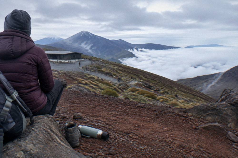
Planning the wider trip around the walk, including where to base yourself and how the booking system works, is covered by Tongariro Alpine Crossing Tours across its route, cost and departure-town guides. The short version: book the date, watch the forecast, and let the track's three famous landmarks do the rest.
Common Questions About The Tongariro Crossing Highlights
What Are The Devil's Staircase, Emerald Lakes And Red Crater?
The Devil's Staircase is the stepped climb of around 350 m from the Mangatepopo Valley to the South Crater plateau, Red Crater is the 1886 m high point of the track, and the Emerald Lakes, Nga Rotopounamu, sit below Red Crater on a steep scree descent. Blue Lake follows shortly after.
How Hard Is The Devil's Staircase Climb?
DOC rates the whole track as requiring high fitness. The staircase is a steady, stepped climb of around 350 m rather than a scramble. The first 5.4 km is shared with the easy two-hour Soda Springs Walk, a fallback for anyone not fit for the harder parts.
Can You Swim In The Emerald Lakes?
No. Ngati Hikairo ki Tongariro ask visitors to respect the sacred mountains by not touching or entering any of the waterways, including the alpine lakes. The lakes also sit near geothermal fumaroles, which DOC advises against approaching.
What Is The Hardest Part Of The Tongariro Crossing?
Red Crater and the steep scree descent to the Emerald Lakes are the most hazardous sections: DOC calls the loose rock on the crater a major slip hazard and attributes 38 percent of tramping injuries to slipping. The long stepped descent to Ketetahi Road can also trouble weaker knees.
Which Tour Walks You Past All Three Landmarks With A Guide?
The Adrift Tongariro premium guided Crossing hike, from $253 per person, covers the full 20.2 km track with a guide and return transport included. The half-day guided walk is a shorter walk and does not cover the full Crossing.
Do You See The Emerald Lakes From A Shuttle?
A shuttle walks the same track as a guided tour, so yes, but a shuttle is transport only, not a guided walk. On this site, only the Adrift Tongariro tours are guided.